Category:Aerial photographs of Landkreis Lörrach
Jump to navigation
Jump to search
Urban districts (cities): Baden-Baden · Freiburg · Heidelberg · Heilbronn · Karlsruhe · Mannheim · Pforzheim · Stuttgart · Ulm
Deutsch: Luftbilder aus dem Landkreis Lörrach in Baden-Württemberg.
Subcategories
This category has the following 7 subcategories, out of 7 total.
E
K
L
R
Media in category "Aerial photographs of Landkreis Lörrach"
The following 36 files are in this category, out of 36 total.
-
 20160601-00481-IRP-Weil-Breisach-I.jpg 3,992 × 2,242; 3.89 MB
-
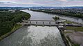 20160619-00687-Stauwehr-Maerkt.jpg 3,992 × 2,242; 3.62 MB
-
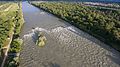 20160619-00695-Isteiner-Schwellen.jpg 3,992 × 2,242; 4.1 MB
-
 2021-05-09-DJI 0010.jpg 4,000 × 2,250; 5.66 MB
-
 2021-05-09-DJI 0014.jpg 4,000 × 2,250; 5.27 MB
-
 2021-05-09-DJI 0017.jpg 4,000 × 2,250; 5.69 MB
-
2021-05-09-Todtnauer-Wasserfall.webm 25 s, 1,920 × 1,080; 55.8 MB
-
 Aerial image of the Herten-Rheinfelden airfield.jpg 3,600 × 2,700; 4.31 MB
-
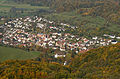
 Aerial View - Inzlingen1.jpg 3,336 × 2,000; 3.85 MB
-
 Aerial View - Inzlingen2.jpg 2,556 × 1,711; 3.22 MB
-
 Aerial View - Inzlingen3.jpg 4,928 × 3,264; 9.11 MB
-
 Aerial View - Kraftwerk Schwörstadt1.jpg 2,544 × 1,464; 2.26 MB
-
 Aerial View - Kraftwerk Schwörstadt2.jpg 2,697 × 1,427; 2.73 MB
-
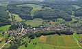
 Aerial View - Nieder- und Obereggenen.jpg 2,826 × 1,880; 4.87 MB
-
 Aerial View - Obereggenen.jpg 4,686 × 2,910; 8.92 MB
-
 Aerial View - Schwörstadt.jpg 2,994 × 1,854; 3.86 MB
-
 Autobahndreieck Weil am Rhein 1985.jpg 1,149 × 1,704; 733 KB
-
 Autobahnzollanlage Basel-Weil am Rhein.jpg 3,372 × 2,400; 12.23 MB
-
 Belchen-2007-12-19.jpg 900 × 598; 155 KB
-
 ETH-BIB-Basel (Weil am Rhein), Schetty AG Färberei-Inlandflüge-LBS MH03-0080.tif 6,432 × 4,904; 90.36 MB
-
 ETH-BIB-Basel (Weil am Rhein), Schetty AG Färberei-Inlandflüge-LBS MH03-0081.tif 6,283 × 4,804; 86.49 MB
-
 ETH-BIB-Basel (Weil am Rhein), Schetty AG Färberei-Inlandflüge-LBS MH03-0083.tif 6,472 × 4,786; 88.75 MB
-
 ETH-BIB-Friedlingen bei Weil am Rhein-Inlandflüge-LBS MH03-1101.tif 6,358 × 4,580; 83.44 MB
-
 ETH-BIB-Grenzach, Wyhlen aus 300 m-Inlandflüge-LBS MH01-004364.tif 6,404 × 4,542; 83.37 MB
-
 ETH-BIB-Grenzach, Wyhlen v. W.-Inlandflüge-LBS MH01-002241.tif 6,726 × 4,552; 87.74 MB
-
 ETH-BIB-Grenzach-Wyhlen, Geigy-Fabrik-Inlandflüge-LBS MH03-1405.tif 6,352 × 4,467; 81.32 MB
-
 ETH-BIB-Grenzach-Wyhlen, Geigy-Fabrik-Inlandflüge-LBS MH03-1521.tif 6,446 × 4,434; 81.9 MB
-
 ETH-BIB-Grenzach-Wyhlen, Geigy-Fabrik-Inlandflüge-LBS MH03-1523.tif 6,419 × 4,434; 81.55 MB
-
 ETH-BIB-Grenzach-Wyhlen, Geigy-Fabrik-Inlandflüge-LBS MH03-1524.tif 6,375 × 4,516; 82.49 MB
-
 ETH-BIB-Grenzach-Wyhlen, Geigy-Fabrik-Inlandflüge-LBS MH03-1636.tif 6,304 × 4,345; 78.5 MB
-

-
 Luftbild - Gelände des heutigen Dreiländergartens Weil am Rhein.jpg 1,518 × 732; 591 KB
-
 Luftbild - Weil am Rhein mit Umgebung.jpg 3,975 × 2,565; 5.19 MB
-
 Luftbild von Friedlingen und Kleinhüningen.jpg 6,386 × 5,023; 20.61 MB
-
 Trassierung Autobahndreieck Weil am Rhein 1962.jpg 1,386 × 942; 379 KB
-
 Weil am Rhein-Otterbach Luftbild (1964).jpg 4,961 × 3,478; 11.68 MB


.jpg)