Category:Aerial photographs of Landkreis Breisgau-Hochschwarzwald
Jump to navigation
Jump to search
Urban districts (cities): Baden-Baden · Freiburg · Heidelberg · Heilbronn · Karlsruhe · Mannheim · Pforzheim · Stuttgart · Ulm
Deutsch: Luftbilder aus dem Landkreis Breisgau-Hochschwarzwald in Baden-Württemberg.
Subcategories
This category has the following 4 subcategories, out of 4 total.
Media in category "Aerial photographs of Landkreis Breisgau-Hochschwarzwald"
The following 97 files are in this category, out of 97 total.
-
 20041230-01107-St-Peter.jpg 3,504 × 2,336; 3.66 MB
-
 2011-11-17 13-17-17 Germany Baden-Württemberg Unadingen.jpg 4,288 × 2,848; 7.14 MB
-
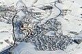
 2016-01-22-St-Ulrich-im-Schwarzwald.jpg 3,992 × 2,992; 5.47 MB
-
 20160428-00168-Schneeburg.jpg 3,992 × 2,242; 4.78 MB
-
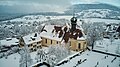
 20160429-00181-Berghauser-Kapelle.jpg 3,992 × 2,242; 4.7 MB
-
 20160519-00366-Berghauser-Matten.jpg 3,992 × 2,242; 4.59 MB
-
 20160526-00414-Plattensee-Schwarzwald.jpg 3,992 × 2,242; 3.93 MB
-
 20160709-00769-Schluchsee-Staumauer.jpg 3,589 × 2,016; 3.37 MB
-
 20160801-00838-St-Trudpert.jpg 3,992 × 2,242; 4.32 MB
-
 20160801-00842-Burg-Baden.jpg 3,992 × 2,242; 4.67 MB
-
 20160801-00845-Hochblauen.jpg 3,992 × 2,242; 3.23 MB
-
 2021-01-08-Bollschweil-Geiersnest.jpg 4,000 × 2,250; 3.94 MB
-
 2021-01-15-Berghauser-Kapelle.jpg 4,000 × 2,250; 4.01 MB
-
 2021-01-15-Sankt-Fides-Soelden.jpg 4,000 × 2,250; 3.73 MB
-
 2021-01-15-Soelden-Saalenberg.jpg 4,000 × 2,250; 3.71 MB
-
 2021-01-15-Soelden-Schwarzwald.jpg 4,000 × 2,250; 3.84 MB
-
 2021-05-12-DJI 0008.jpg 4,000 × 2,250; 4.33 MB
-
 20220226-DJI 0273.jpg 4,200 × 2,798; 5.54 MB
-
 20220530-DJI 0348.jpg 4,000 × 2,665; 5.21 MB
-
 2023.03.22-DJI 0621 Ruins of Schneeburg Castle, aerial view.jpg 4,500 × 3,370; 13.18 MB
-
 20230422-DJI 0907.jpg 4,500 × 3,370; 12.61 MB
-
 20230427-DJI 0927.jpg 4,500 × 3,370; 14.94 MB
-
 Aerial image of the Bremgarten airfield.jpg 5,500 × 2,600; 6.18 MB
-
 Aerial image of the Friedenweiler monastery (view from the southwest).jpg 3,000 × 2,100; 3.43 MB
-
 Aerial image of the Kirchzarten gliding site.jpg 4,500 × 3,200; 6.26 MB
-
 Aerial image of the Müllheim gliding site.jpg 4,100 × 3,400; 6.37 MB
-
 Aerial image of the Reiselfingen gliding site.jpg 4,800 × 3,000; 7.43 MB
-
 Aerial View - Badenweiler1.jpg 2,608 × 1,672; 3.85 MB
-
 Aerial View - Badenweiler2.jpg 2,688 × 1,564; 3.71 MB
-
 Aerial View - Badenweiler3.jpg 2,592 × 1,724; 4.34 MB
-
 Aerial View - Badenweiler4.jpg 2,612 × 1,636; 4.66 MB
-
 Aerial View - Badenweiler5.jpg 2,826 × 1,880; 5.46 MB
-
 Aerial View - Badenweiler6.jpg 2,389 × 1,663; 3.06 MB
-
 Aerial View - Badenweiler7.jpg 2,563 × 1,742; 3.51 MB
-
 Aerial View - Bollschweil und Kalkwerk.jpg 4,702 × 2,959; 7.83 MB
-
 Aerial View - Bollschweil und Kalkwerk2.jpg 4,232 × 2,332; 7.05 MB
-
 Aerial view - Hochblauen1.jpg 4,928 × 3,264; 5.88 MB
-
 Aerial view - Hochblauen2.jpg 4,052 × 2,560; 5.74 MB
-
 Aerial view - Hochblauen3.jpg 3,956 × 2,496; 5.71 MB
-
 Aerial view - Kloster St. Trudpert.jpg 2,893 × 1,724; 3.49 MB
-
 Aerial view - Kloster St. Trudpert2.jpg 4,928 × 3,264; 8.92 MB
-
 Aerial View - Landschaft Markgräflerland (crop).jpg 1,121 × 580; 488 KB
-
 Aerial View - Landschaft Markgräflerland1.jpg 3,252 × 2,154; 6.77 MB
-
 Aerial View - Münstertal.jpg 4,000 × 2,416; 6.24 MB
-
 Aerial View - Rosskopf1.jpg 4,928 × 3,264; 7.02 MB
-
 Aerial View - Rosskopf2.jpg 4,027 × 2,239; 3.89 MB
-
 Aerial View - Schwarzwaldausläufer1.jpg 4,104 × 2,500; 5.45 MB
-
 Aerial View - Schwarzwaldausläufer2.jpg 4,092 × 2,424; 5.77 MB
-
 Aerial View - Schwarzwaldausläufer3.jpg 3,932 × 2,368; 4.84 MB
-
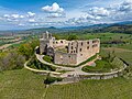
 Aerial View - Staufen im Breisgau - Burgruine1.jpg 4,730 × 2,821; 8.89 MB
-
 Aerial View - Staufen im Breisgau1.jpg 3,252 × 2,154; 5.05 MB
-
 Aerial View - Staufen im Breisgau2.jpg 3,252 × 2,154; 5.06 MB
-
 Aerial View - Sulzburg - St. Cyriak.jpg 4,174 × 3,019; 7.12 MB
-
 Aerial View - Sulzburg - St. Cyriak2.jpg 4,928 × 3,264; 8.88 MB
-
 Aerial View - Sulzburg1.jpg 4,928 × 3,264; 8.98 MB
-
 Aerial View - Sulzburg2.jpg 4,928 × 3,264; 9.11 MB
-
 Badenweiler 001.650.jpg 650 × 488; 95 KB
-
 Belchen-2007-12-19.jpg 900 × 598; 155 KB
-
 Boetzingen 22.650.jpg 650 × 433; 124 KB
-
 Eichstetten 009.650.jpg 650 × 488; 86 KB
-
 Eschbach, Flugplatz Bremgarten.jpg 4,032 × 2,268; 4.87 MB
-
 Flugplatz Reiselfingen.jpg 2,048 × 1,536; 1.14 MB
-
 Gundelfingen 004.650.jpg 650 × 488; 108 KB
-
 Ihringen 025.650.jpg 650 × 488; 92 KB
-
 Kaiserstuhl Vogtsburg.jpg 640 × 480; 83 KB
-
 Kandel-Waldkirch-Furtwangen.jpg 4,320 × 2,432; 7.98 MB
-
 Kirchzarten Luftaufnahme.JPG 1,998 × 1,600; 2.34 MB
-
 Luftbild Achkarren morgens.jpg 650 × 488; 88 KB
-
 Luftbild Alt-Vogtsburg.jpg 650 × 486; 83 KB
-
 Luftbild Bickensohl.jpg 650 × 488; 138 KB
-
 Luftbild Bischoffingen.jpg 650 × 488; 89 KB
-
 Luftbild Burkheim.jpg 650 × 488; 96 KB
-
 Luftbild Burkheimer-Baggersee.jpg 800 × 536; 118 KB
-
 Luftbild Niederrotweil.jpg 650 × 488; 82 KB
-
 Luftbild Oberbergen.jpg 650 × 488; 112 KB
-
 Luftbild Oberrotweil.jpg 650 × 488; 87 KB
-
 Luftbild Schelingen.jpg 650 × 488; 83 KB
-
 Luftbild vom Breisgau.jpg 650 × 488; 119 KB
-
 March 001.t.jpg 650 × 488; 105 KB
-
 Markgraeflerland 001.650.jpg 650 × 488; 163 KB
-
 Merdingen 002.650.jpg 650 × 488; 95 KB
-
 Reiselfingen Biotop.jpg 800 × 533; 240 KB
-
 Reiselfingen Kiesgrube.jpg 800 × 600; 207 KB
-
 Reislefingen Ort.jpg 800 × 533; 299 KB
-
 Rhein 800.jpg 800 × 536; 226 KB
-
 Rimsingen 004.650.jpg 650 × 450; 89 KB
-
 Sankt-Märgen-2007-12-19.jpg 900 × 598; 213 KB
-
 Schelingen 10.650.jpg 650 × 488; 76 KB
-
 Schluchsee Luftbild.jpg 1,200 × 1,600; 271 KB
-
 Staufen 001.650.jpg 650 × 488; 97 KB
-
 SW-Sued.JPG 788 × 566; 34 KB
-
 Südschwarzwald mit Belchen.jpg 4,320 × 2,432; 7.75 MB
-
 Totenkopf 001.jpg 650 × 488; 56 KB
-
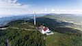
 Totenkopf Fernmeldeturm.jpg 3,872 × 2,592; 3.96 MB
-
 Tuniberg Erentrudiskapelle01 2016-03-28.jpg 2,560 × 1,440; 1.83 MB
-
 Tuniberg.jpg 2,048 × 1,536; 2.41 MB
-
 Tuniberg01 2016-03-28.jpg 2,560 × 1,440; 1.89 MB


.jpg)


.jpg)


