Category:Aerial photographs of Fukuoka prefecture
Appearance
| Prefectures of Japan | |||
|---|---|---|---|
| Hokkaido | Aomori · Iwate · Miyagi · Akita · Yamagata · Fukushima · Ibaraki · Tochigi · Gunma · Saitama · Chiba · Tokyo · Kanagawa · Niigata · Toyama · Ishikawa · Fukui · Yamanashi · Nagano · Gifu · Shizuoka · Aichi · Mie · Shiga · Kyoto · Osaka · Hyogo · Nara · Wakayama · Tottori · Shimane · Okayama · Hiroshima · Yamaguchi | Tokushima · Kagawa · Ehime · Kōchi | Fukuoka · Saga · Nagasaki · Kumamoto · Ōita · Miyazaki · Kagoshima | Okinawa | 
| ||
Subcategories
This category has only the following subcategory.
Media in category "Aerial photographs of Fukuoka prefecture"
The following 117 files are in this category, out of 117 total.
-
20080813UmiNoNakamichiM.jpg 1,280 × 960; 114 KB
-
17-DEC-2022 - TW293 ICN-FUK (B737-800 - HL8294) (04).jpg 2,048 × 1,536; 379 KB
-
Adventure pool, Kitakyushu-Kokuraminami.jpg 444 × 639; 241 KB
-
Aerial photograph around the main district of Munakata city, Fukuoka Prefecture.2010.jpg 12,132 × 6,264; 25.5 MB
-
Aerial photograph of the area around the Chikugo River sandbar delta on Ono Island.jpg 8,957 × 14,998; 81.35 MB
-
Aerial photographs of Moji interchange.jpg 2,720 × 1,400; 2.18 MB
-
Aino-shima Island Kokura-kita Ward Aerial photograph.1974.jpg 5,409 × 3,047; 12.44 MB
-
Aino-shima Island, Kokura-kita Ward Aerial photograph.2009.jpg 3,269 × 4,708; 3.28 MB
-
Ainoshima Island, Shingu Fukuoka Aerial photograph.2010.jpg 4,252 × 3,189; 1.47 MB
-
Ariake sea nori nets.jpg 880 × 800; 149 KB
-
Asakura city Amagi district Aerial photograph.2017.jpg 6,632 × 4,974; 11.37 MB
-
Ashiya.airfield.aerial shoot.jpg 3,648 × 2,736; 6.75 MB
-
Buzen city center area Aerial photograph.2013.jpg 3,062 × 2,285; 2.3 MB
-
Chikugo city center area Aerial photograph.2010.jpg 5,468 × 4,101; 7.59 MB
-
Chikugo Ozeki Weir Aerial photograph.1987.jpg 3,585 × 2,591; 6.6 MB
-
Chikugo River Lift bridge aerial.jpg 1,000 × 1,000; 203 KB
-
Chikushino city center area Aerial photograph.2017.jpg 6,241 × 4,681; 11.97 MB
-
CKU20081-C27-43.jpg 1,900 × 1,468; 1.48 MB
-
CKU20101-C12-8.jpg 1,004 × 792; 598 KB
-
Dazaifu city center area Aerial photograph.2017.jpg 8,424 × 6,318; 22.75 MB
-
Dazaifu Golf Club, Dazaifu Fukuoka Aerial photograph.2007.jpg 4,232 × 3,174; 5.39 MB
-
Dokai Bay Aerial photograph.2005.jpg 8,038 × 4,674; 13.34 MB
-
Former Motooka Airfield Site.jpg 1,025 × 769; 644 KB
-
Fukuoka Airport Aerial photograph.2007.jpg 1,360 × 3,080; 4.03 MB
-
Fukuoka Castle Aerial photograph 2020.jpg 3,600 × 2,600; 4.99 MB
-
Fukuoka Castle air.jpg 2,702 × 2,286; 3.22 MB
-
Fukuoka Country Club, Higashi-ku Fukuoka Aerial photograph.2007.jpg 3,971 × 2,979; 4.64 MB
-
Fukuoka Najima sports park air 1987.jpg 530 × 397; 139 KB
-
Fukuoka Nishi park air 1987.jpg 1,110 × 833; 461 KB
-
Fukuoka Seaside Momochi Aerial Shoot.jpg 3,988 × 2,648; 2.24 MB
-
Fukuoka Shingu Ainoshima aerial shoot.jpg 3,648 × 2,736; 5.86 MB
-
Fukutsu city center area Aerial photograph.2010.jpg 4,484 × 3,363; 4.6 MB
-
Futamata Tunnel Explosion Accident 1945.jpg 1,060 × 795; 603 KB
-
Gannos Airport 1974.jpg 2,192 × 2,192; 1.39 MB
-
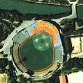
Heiwadai Stadium 1987.jpg 374 × 374; 59 KB
-
Heiwadai Stadium 1987.png 500 × 500; 626 KB
-
Heiwadai stadium air 1987.jpg 361 × 361; 71 KB
-
Himeshima, cku-81-1 c37 3.jpg 2,032 × 2,304; 817 KB
-
Iizuka city center area Aerial photograph.2007.jpg 6,512 × 8,535; 19.24 MB
-
Inatsuki district Kama city Aerial photograph.2007.jpg 4,467 × 5,198; 7.55 MB
-
Irifunemachi seaplane base site.jpg 796 × 597; 459 KB
-
Itoshima city Maebaru district Aerial photograph.2001.jpg 1,554 × 1,169; 750 KB
-
JGSDF Camp Iiduka.jpg 2,267 × 2,181; 3.99 MB
-
Jinoshima aerial shot.jpg 3,648 × 2,736; 6.6 MB
-
Jinoshima Island, Munakata Fukuoka Aerial photograph.2010.jpg 5,496 × 4,122; 2.76 MB
-
Kaho district Kama city Aerial photograph.2009.jpg 3,998 × 2,998; 4.17 MB
-
Kasuga city center area Aerial photograph.2007.jpg 3,617 × 2,713; 4.33 MB
-
Katsushima in Munakata City.jpg 3,648 × 2,736; 7.01 MB
-
Kitakyushu Airport Aerial photograph.2009.jpg 4,989 × 9,027; 12.48 MB
-
Kitakyushu Airport air 1974.jpg 2,465 × 1,386; 1.78 MB
-
Koga Golf Club, Koga Fukuoka Aerial photograph.2007.jpg 3,666 × 2,750; 3.56 MB
-
Kokudo-chiriin kōkūshashin CKU20201-C21-45 part Gofukumachi 20230906.jpg 1,776 × 1,776; 516 KB
-
Kokudo-chiriin kōkūshashin CKU20201-C21-46 part 20230729.jpg 1,152 × 1,152; 245 KB
-
Kokudo-chiriin kōkūshashin CKU20201-C21-49 part 20230819.jpg 1,680 × 1,680; 471 KB
-
Kokudo-chiriin kōkūshashin CKU20201-C22-50 part Yakuin 20230913.jpg 2,160 × 2,160; 793 KB
-
Kokudo-chiriin kōkūshashin CKU20201-C24-41 part 20230830.jpg 1,616 × 2,880; 649 KB
-
Kokudo-chiriin kōkūshashin CKU20201-C24-43 part 20230730.jpg 1,440 × 1,440; 346 KB
-
Kokudo-chiriin kōkūshashin CKU20201-C26-39 part 20230820.jpg 1,296 × 2,304; 496 KB
-
Kokudo-chiriin kōkūshashin CKU20201-C28-27 part 20230903.jpg 2,880 × 2,880; 1.21 MB
-
Kokudo-chiriin kōkūshashin CKU20201-C28-29 part 20230903.jpg 1,152 × 2,048; 331 KB
-
Kokudo-chiriin kōkūshashin CKU20201-C29-28 part 20230816.jpg 1,344 × 1,344; 266 KB
-
Kokura Comprehensive Vehicle Center.2009.04.jpg 900 × 1,600; 1.31 MB
-
Kokura Country Club, Kokuraminami-ku Kitakyushu Aerial photograph.2009.jpg 3,496 × 2,622; 3.47 MB
-
Kokura Racecourse Aerial photograph 2009.jpg 2,952 × 2,573; 2.62 MB
-
Kokura Racecourse Aerial photograph.1974.jpg 2,690 × 1,941; 4.94 MB
-
Kurume Castle air.jpg 1,601 × 1,452; 1.02 MB
-
Kurume city center area Aerial photograph.2010.jpg 13,091 × 9,818; 41.09 MB
-
Marinatown-197501.jpg 2,833 × 2,185; 1.8 MB
-
Marinatown-198310.jpg 1,336 × 923; 289 KB
-
Marinatown-198709.jpg 3,210 × 2,261; 1.47 MB
-
Marinatown-199305.jpg 1,199 × 824; 234 KB
-
Marinatown-200707.jpg 3,543 × 2,339; 3.24 MB
-
Miike-Jima Island, Omuta Fukuoka Aerial photograph.2008.jpg 1,085 × 814; 320 KB
-
Miyama city Setaka district Aerial photograph.2008.jpg 5,179 × 3,884; 5.68 MB
-
Miyawaka city Miyata district Aerial photograph.2007.jpg 4,374 × 3,281; 4.34 MB
-
Miyawaka city Wakamiya district Aerial photograph.2007.jpg 3,410 × 2,557; 2.41 MB
-
Mizuki a 1975.jpg 1,952 × 1,528; 2.2 MB
-
MKU611-C2-17.jpg 1,425 × 2,002; 1,014 KB
-
Mushiroda airfield aerial photograph 1947.jpg 2,212 × 1,659; 2.94 MB
-
Mutsure-jima Island and Uma-shima Island Aerial photograph.1974.jpg 3,885 × 2,813; 8.3 MB
-
Mutsure.island.jpg 3,648 × 2,736; 7.58 MB
-
Nakagawa city center area Aerial photograph.2018.jpg 4,290 × 5,721; 9.11 MB
-
Nakama city center area Aerial photograph.2010.jpg 6,674 × 4,068; 10.03 MB
-
Nogata city center area Aerial photograph.2007.jpg 6,353 × 4,764; 10.74 MB
-
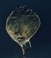
Nokonoshima Island Aerial photograph.2007.jpg 4,801 × 7,266; 18.81 MB
-
Ogori Athletic Stadium.jpg 892 × 1,003; 383 KB
-
Ogori city center area Aerial photograph.2010.jpg 4,591 × 3,443; 4.73 MB
-
Okawa city center area Aerial photograph.2008.jpg 5,733 × 4,299; 7.4 MB
-
Okayama(Chikugo)-Airfield-CKU20101-C35-7.jpg 3,285 × 3,258; 9.62 MB
-
Okayama(Chikugo)-Airfield-CKU813-C17-64.jpg 3,268 × 3,186; 9.07 MB
-
Okayama(Chikugo)-Airfield-USA-M665-125.jpg 2,144 × 2,144; 1.79 MB
-
Okinoshima aerial01.jpg 1,500 × 1,400; 341 KB
-
Omuta city center area Aerial photograph.2016.jpg 12,698 × 9,523; 37.35 MB
-
Onojo city center area Aerial photograph.2007.jpg 3,603 × 4,804; 7.85 MB
-
Orono Island, Fukuoka.jpg 2,697 × 2,657; 608 KB
-
Oronoshima Island, Nishi-ku fukuoka Aerial photograph.2014.jpg 3,805 × 2,853; 3.53 MB
-
Oshima Island, Munakata Fukuoka Aerial photograph.2010.jpg 8,214 × 6,162; 9.35 MB
-
Oshima island.jpg 3,648 × 2,736; 5.65 MB
-
Otake Short Course, Higashi-ku Fukuoka Aerial photograph.2007.jpg 1,890 × 1,416; 1.41 MB
-
Saitozaki Sea Side Country Club, Higashi-ku Fukuoka Aerial photograph.2007.jpg 3,114 × 2,335; 2.89 MB
-
Sasaguru Kasuya Research Forest, Kyushu University Aerial Photograph.2007.jpg 1,802 × 1,201; 875 KB
-
Shikanoshima aerial shoot.jpg 3,648 × 2,736; 5.86 MB
-
Shirashima Island, Wakamatsu Kitakyushu Aerial photograph.2009.jpg 3,000 × 2,250; 1.5 MB
-
Sumitomo Metal Industries Kokura Aerial Photograph 2009.jpg 5,217 × 3,913; 5.9 MB
-
Tagawa city center area Aerial photograph.2009.jpg 4,328 × 3,246; 4.82 MB
-
The Classic Golf Club, Miyawaka Fukuoka Aerial photograph.2010.jpg 2,702 × 3,602; 3.11 MB
-
The Queen’s Hill Golf Club, Itoshima Fukuoka Aerial photograph.2001.jpg 1,282 × 954; 444 KB
-
Ukiha city main areas Aerial photograph.2018.jpg 14,438 × 5,661; 26.42 MB
-
Usui district Kama city Aerial photograph.2007.jpg 4,346 × 3,259; 4.36 MB
-
Wajiro mudflat Aerial photograph.1987.jpg 4,015 × 2,903; 7.24 MB
-
Wakamatsu Golf Club, Wakamatsu-ku Kitakyushu Aerial photograph.2016.jpg 4,396 × 3,297; 4.22 MB
-
Yamada district Kama city Aerial photograph.2009.jpg 2,706 × 2,008; 2.5 MB
-
Yame city center area Aerial photograph.2010.jpg 5,962 × 4,471; 8.19 MB
-
Yanagawa city center area Aerial photograph.2008.jpg 6,708 × 5,030; 10.57 MB
-
Yukuhashi city center area Aerial photograph.2009.jpg 6,397 × 4,798; 11.39 MB
-
宮若市犬鳴 航空写真 CKU951X-C5-9.jpg 1,189 × 1,701; 781 KB


