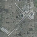
Category:Aerial photographs of Fort Wayne, Indiana
Jump to navigation
Jump to search
- 100 most populous cities of the United States
- 1–25
- Austin
- Boston
- Charlotte
- Chicago
- Columbus
- Houston
- Indianapolis
- Los Angeles
- Nashville
- New York City
- Oklahoma City
- Philadelphia
- Phoenix
- Portland
- San Antonio
- San Diego
- San Francisco
- San Jose
- Seattle
- Washington, D.C.
- 26–50
- Albuquerque
- Atlanta
- Baltimore
- Colorado Springs
- Detroit
- Kansas City
- Las Vegas
- Long Beach
- Memphis
- Miami
- Milwaukee
- Minneapolis
- Oakland
- Sacramento
- 51–75
- Anchorage
- Cincinnati
- Cleveland
- Durham
- Henderson
- Honolulu
- Lincoln
- Newark
- New Orleans
- Orlando
- Pittsburgh
- Riverside
- Saint Paul
- St. Louis
- Tampa
- 76–100
- Buffalo
- Fort Wayne
- Fremont
- Madison
- Norfolk
- Reno
- Richmond
- Spokane
- Toledo
- Winston-Salem
Media in category "Aerial photographs of Fort Wayne, Indiana"
The following 10 files are in this category, out of 10 total.
-
Aerial view of Fort Wayne, September 2019.JPG 3,661 × 2,442; 2.97 MB
-
Allen County War Memorial Coliseum April 2020.jpg 3,844 × 3,050; 5.63 MB
-
Baer Army Air Base - IN - 24 November 1943.jpg 730 × 451; 93 KB
-
Baeraaf-8apr1988.jpg 400 × 429; 55 KB
-
Fort Wayne International Airport - USGS 10 April 2002.jpg 2,000 × 2,000; 462 KB
-
Northern End of Fort Wayne, Indiana (7981695349).jpg 4,000 × 3,000; 2.58 MB
-
Northern End of Fort Wayne, Indiana (7981696028).jpg 4,000 × 3,000; 2.27 MB
-
Northern End of Fort Wayne, Indiana (7981696289).jpg 4,000 × 3,000; 2.65 MB
-
Northern End of Fort Wayne, Indiana (7981697038).jpg 4,000 × 3,000; 2.52 MB
-
Smith Field KSMD - USGS 6 April 1998.jpg 1,200 × 900; 153 KB


