Category:Aerial photographs of Austin, Texas
Jump to navigation
Jump to search
State capitals of the United States: Annapolis [MD] · Atlanta [GA] · Austin [TX] · Bismarck [ND] · Boston [MA] · Carson City [NV] · Cheyenne [WY] · Columbus [OH] · Des Moines [IA] · Honolulu [HI] · Indianapolis [IN] · Juneau [AK] · Lincoln [NE] · Madison [WI] · Montgomery [AL] · Nashville [TN] · Oklahoma City [OK] · Phoenix [AZ] · Providence [RI] · Richmond [VA] · Sacramento [CA] · Saint Paul [MN] · Trenton [NJ] · Federal district: Washington, D.C. [DC] · Insular area of the United States
Subcategories
This category has only the following subcategory.
Media in category "Aerial photographs of Austin, Texas"
The following 36 files are in this category, out of 36 total.
-
 Aerial - Austin, TX ENE toward Walter E. Long Metropolitan Park.jpg 4,288 × 2,848; 8.4 MB
-
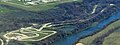
 Aerial - Colorado River and Emma Long Metropolitan Park 01.jpg 4,288 × 2,848; 8.87 MB
-
 Aerial - Colorado River between Tarrytown, Austin, TX and West Lake Hills.jpg 4,288 × 2,848; 8.24 MB
-
 Aerial - Colorado River north of Austin-Bergstrom International Airport 01.jpg 4,288 × 2,848; 7.06 MB
-
 Aerial - Colorado River north of Austin-Bergstrom International Airport 02.jpg 4,288 × 2,848; 6.93 MB
-
 Aerial - Colorado River west of Austin, Texas, looking north 01.jpg 4,288 × 2,848; 9.45 MB
-
 Aerial - Colorado River west of Austin, Texas, looking north 02.jpg 4,288 × 2,848; 8.75 MB
-
 Aerial - Hancock and Cherrywood, Austin, Texas 01.jpg 4,288 × 2,848; 6.27 MB
-
 Aerial - Hyde Park, Austin, Texas 01.jpg 4,288 × 2,848; 6.75 MB
-
 Aerial - North central Austin, Texas 01.jpg 4,288 × 2,848; 6.86 MB
-
 Aerial view of Hilton Austin Airport Hotel 01.jpg 4,288 × 2,848; 7.34 MB
-
 AUSAirportAerial1.JPG 3,008 × 2,000; 2.28 MB
-
 AUSAirportAerial2.JPG 1,482 × 988; 1.28 MB
-
 Austin aerial.JPG 3,296 × 2,472; 1.2 MB
-
 Austin City Skyline Aerial (49563590036).jpg 3,600 × 2,400; 3.51 MB
-
 Austin Texas.jpg 2,008 × 3,032; 2.79 MB
-
 Austin tx satellite map.jpg 550 × 767; 116 KB
-
 Austin, Texas, under snow cover - February 15th, 2021 (50956349262).jpg 4,965 × 2,516; 6.71 MB
-
 Austin-Bergstrom International Airport - aerial 01 (cropped).jpg 3,287 × 2,030; 4.87 MB
-
 Austin-Bergstrom International Airport - aerial 01.jpg 4,288 × 2,848; 6.86 MB
-
 Austin-Bergstrom International Airport aerial.jpg 2,935 × 1,813; 3.67 MB
-
 Austin-Bergstrom International Airport tower and other buildings (low aerial) 01.jpg 4,288 × 2,848; 4.83 MB
-
 Bergstrom Air Force Base aerial photo.jpg 594 × 608; 154 KB
-
 Circuit of the Americas Ess Curves Aerial - June 2015 (52538202379).jpg 2,400 × 3,600; 3.82 MB
-
 Circuit of the Americas, April 22, 2018 SkySat (cropped).jpg 1,683 × 2,468; 1.06 MB
-
 Circuit of the Americas, April 22, 2018 SkySat (cropped2).jpg 2,560 × 1,440; 1.03 MB
-
 Circuit of the Americas, April 22, 2018 SkySat.jpg 3,362 × 2,522; 2.29 MB
-
 CircuitOfTheAmericasAerial-July2015.jpg 4,272 × 2,848; 4.49 MB
-
 Driveway austin aerial.jpg 700 × 261; 77 KB
-
 ISS-46 Austin Texas.jpg 4,928 × 3,280; 3.32 MB
-
 Lake Travis aerial 2018.jpg 3,264 × 2,448; 1.18 MB
-
 Looking South from the Austonian - panoramio.jpg 1,632 × 920; 391 KB
-
 TexasStateCapitolAerial.JPG 1,224 × 816; 1.08 MB
-
 Town lake 1980.jpg 1,803 × 1,202; 1.79 MB
-
 Us290 and I35 austin.jpg 2,508 × 3,168; 1.08 MB
-
 USGIF (Austin, TX).tiff 6,724 × 6,724, 5 pages; 66.51 MB


.jpg)


.jpg)
.jpg)


_01.jpg)

.jpg)
.jpg)
.jpg)


