Category:Administrative city maps of Munich
Jump to navigation
Jump to search
Subcategories
This category has only the following subcategory.
L
Media in category "Administrative city maps of Munich"
The following 18 files are in this category, out of 18 total.
-
 Karte der Gemarkungen und Stadtbezirke in München.png 2,001 × 1,669; 1.52 MB
-
 Karte der Ortsbezeichnungen in München.png 5,559 × 4,637; 10.31 MB
-
 Karte der Stadtbezirke in München in der bis 1992 gültigen Gliederung.png 2,002 × 1,670; 1.49 MB
-
 Karte der Stadtbezirke in München.png 2,002 × 1,670; 1.47 MB
-
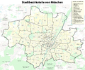 Karte der Stadtbezirksteile in München.png 3,335 × 2,782; 5.09 MB
-
 Munich Blank Map.svg 746 × 577; 51 KB
-
 Munich Subdivisions grey numbered.svg 1,944 × 1,524; 1.83 MB
-
 Munich Subdivisions grey.svg 1,944 × 1,524; 1.05 MB
-
 Munich Subdivisions numbered.svg 1,944 × 1,524; 1.83 MB
-
 Munich Subdivisions.svg 1,944 × 1,524; 1.12 MB
-
 München - Stadtbezirke (Karte) - V2.png 756 × 588; 113 KB
-
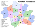
 München - Stadtbezirke (Karte).png 2,119 × 1,641; 338 KB
-
 München - Stadtbezirke und Stadtbezirksteile (Karte).svg 746 × 577; 129 KB
-
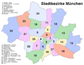
 München városrészei.png 2,119 × 1,641; 313 KB
-
 Positionskarte München.png 4,169 × 3,259; 2.77 MB
-
 Stadtbezirke Lage in München.jpg 769 × 600; 66 KB
-
 Stadtbezirke Lage in München.png 500 × 378; 38 KB
-
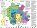 Stadterweiterungen München.png 2,360 × 1,813; 760 KB


_-_V2.png)
.png)
.svg)


