Category:City maps of Munich
Jump to navigation
Jump to search

Subcategories
This category has the following 3 subcategories, out of 3 total.
A
B
O
Media in category "City maps of Munich"
The following 34 files are in this category, out of 34 total.
-
 Karte München Basiskarte.jpg 17,078 × 17,847; 65.94 MB
-
 Karte München Basiskarte.png 8,322 × 9,249; 36.48 MB
-
 Karte München Landnutzung.png 8,322 × 9,249; 22.32 MB
-
 Karte München Schwarzplan.png 8,322 × 9,249; 10.34 MB
-
 Karte München ÖPNV.png 8,322 × 9,249; 6.36 MB
-
 Karte München Übersichtsplan.png 8,322 × 9,249; 30.65 MB
-
 Karte der Denkmalschutzensembles in München.jpg 11,447 × 8,854; 33.69 MB
-
 Karte der Gemarkungen in München.png 2,001 × 1,669; 1.32 MB
-
 Karte der Ortsbezeichnungen in München.png 5,559 × 4,637; 10.31 MB
-
 Karte Fernstraßen München.png 2,473 × 2,211; 643 KB
-
 Karte Mittlerer Ring München.png 1,499 × 1,392; 530 KB
-
 Munich City Center.png 3,000 × 2,426; 1.9 MB
-
 Munich City Center.svg 1,960 × 1,290; 326 KB
-
 Munich location map.png 657 × 506; 491 KB
-
 München - Basiskarte farbig - Flaucher bis Englischer Garten.png 1,692 × 2,139; 2.41 MB
-
 München - Basiskarte farbig - mit Nachbargemeinden.jpg 10,375 × 9,088; 14.24 MB
-
 München - Basiskarte farbig - mit Nachbargemeinden.png 7,256 × 5,986; 22.91 MB
-
 München - Basiskarte farbig.pdf 4,593 × 3,770; 8.06 MB
-
 München - Basiskarte farbig.png 3,675 × 3,017; 4.44 MB
-
 München - Basiskarte grau.pdf 4,593 × 3,770; 8.16 MB
-
 München - Basiskarte grau.png 3,675 × 3,017; 3.49 MB
-
 München -- Karte der Stimmkreise bei der Landtagswahl 2008.svg 811 × 566; 124 KB
-
 München -- Karte der Stimmkreise bei der Landtagswahl 2018.svg 810 × 565; 33 KB
-
 Postleitzahlenkarte München (großer Maßstab).jpg 4,221 × 3,257; 4.7 MB
-
 Postleitzahlenkarte München (kleiner Maßstab).jpg 16,885 × 13,030; 46.46 MB
-
 Postleitzahlenkarte München (mittlerer Maßstab).jpg 8,442 × 6,515; 15.68 MB
-
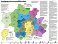 Stadterweiterungen München.png 2,360 × 1,813; 760 KB
-

-

-

-

-

-

-


.jpg)
.jpg)
.jpg)


