Category:Aberlemno (civil parish)
Jump to navigation
Jump to search
Scottish parish in Angus, Scotland, UK | |||||
| Upload media | |||||
| Instance of | |||||
|---|---|---|---|---|---|
| Named after | |||||
| Location |
| ||||
| Population |
| ||||
| Area |
| ||||
 | |||||
Media in category "Aberlemno (civil parish)"
The following 200 files are in this category, out of 263 total.
(previous page) (next page)-
 A farm track - geograph.org.uk - 4805774.jpg 800 × 600; 230 KB
-
 A long straight road - geograph.org.uk - 4803466.jpg 800 × 600; 250 KB
-
 A road into Montreathmont Forest - geograph.org.uk - 4803458.jpg 800 × 600; 208 KB
-
 A view to Flemington - geograph.org.uk - 5016253.jpg 4,608 × 3,456; 3.31 MB
-
 Aberlemno Battle Scene - geograph.org.uk - 1811234.jpg 2,304 × 3,456; 1.45 MB
-
 Aberlemno Church - geograph.org.uk - 6365834.jpg 1,024 × 683; 236 KB
-
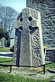
 Aberlemno Cross Stone - geograph.org.uk - 1811209.jpg 2,284 × 3,442; 1.83 MB
-
 Aberlemno Kirk - geograph.org.uk - 1811193.jpg 3,368 × 2,164; 1.16 MB
-
 Aberlemno Kirk - geograph.org.uk - 1859642.jpg 640 × 480; 94 KB
-
 Aberlemno Kirk - geograph.org.uk - 3750172.jpg 640 × 480; 61 KB
-
 Aberlemno Kirk - geograph.org.uk - 4593565.jpg 640 × 480; 75 KB
-
 Aberlemno Kirkyard Stone - geograph.org.uk - 1859629.jpg 480 × 640; 158 KB
-
 Aberlemno Kirkyard Stone - geograph.org.uk - 1859633.jpg 480 × 640; 153 KB
-
 Aberlemno Parish Church - geograph.org.uk - 5817408.jpg 640 × 480; 90 KB
-
 Aberlemno Pictish Churchyard Cross - geograph.org.uk - 5817417.jpg 480 × 640; 144 KB
-
 Aberlemno Pictish Stone - geograph.org.uk - 3058737.jpg 636 × 640; 108 KB
-
 Aberlemno Pictish Stone - geograph.org.uk - 3061750.jpg 413 × 640; 42 KB
-
 Aberlemno Sculptured Stone - geograph.org.uk - 1859603.jpg 481 × 640; 95 KB
-
 Aberlemno Sculptured Stone - geograph.org.uk - 1859605.jpg 480 × 640; 129 KB
-
 Aberlemno Sculptured Stone - geograph.org.uk - 1859615.jpg 480 × 640; 123 KB
-
 Aberlemno Stone - geograph.org.uk - 1810879.jpg 2,304 × 3,456; 1.44 MB
-
 Aberlemno Stone - geograph.org.uk - 3997289.jpg 800 × 533; 97 KB
-
 Aberlemno stones - geograph.org.uk - 4808204.jpg 800 × 600; 157 KB
-
 Access road to Howmuir - geograph.org.uk - 4603306.jpg 640 × 481; 63 KB
-
 All that's left of Woodend - geograph.org.uk - 2612574.jpg 640 × 480; 75 KB
-
 Apple Tree - geograph.org.uk - 6568765.jpg 1,024 × 615; 101 KB
-
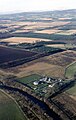
 Arable land near Netherton - geograph.org.uk - 4805783.jpg 800 × 600; 182 KB
-
 Arable land, Balgavies - geograph.org.uk - 4803442.jpg 800 × 600; 150 KB
-
 Arable land, Hillbarns - geograph.org.uk - 4805805.jpg 800 × 600; 222 KB
-
 Auldbar Road Station House - geograph.org.uk - 6374462.jpg 1,024 × 683; 172 KB
-
 B9134 - geograph.org.uk - 4805787.jpg 800 × 600; 191 KB
-
 B9134 - geograph.org.uk - 4805807.jpg 800 × 600; 173 KB
-
 B9134 - geograph.org.uk - 4808189.jpg 800 × 600; 152 KB
-
 B9134 - geograph.org.uk - 4808210.jpg 800 × 600; 156 KB
-
 B9134 - geograph.org.uk - 4808379.jpg 800 × 600; 167 KB
-
 B9134 approaching Crosston - geograph.org.uk - 4603288.jpg 640 × 481; 43 KB
-
 B9134 at Netherton - geograph.org.uk - 5882730.jpg 5,184 × 3,888; 6.2 MB
-
 B9134 near Aberlemno - geograph.org.uk - 3266058.jpg 1,200 × 797; 428 KB
-
 B9134, Aldbar - geograph.org.uk - 4805761.jpg 800 × 600; 167 KB
-
 B9341 - geograph.org.uk - 4808145.jpg 800 × 600; 136 KB
-
 Back of Turin Hill - geograph.org.uk - 4808221.jpg 800 × 600; 173 KB
-
 Balbinny - geograph.org.uk - 5662068.jpg 640 × 427; 267 KB
-
 Balgavies Loch - geograph.org.uk - 2630086.jpg 3,264 × 2,448; 4.95 MB
-
 Balgavies Loch - geograph.org.uk - 2630390.jpg 3,264 × 2,448; 4.65 MB
-
 Balgavies Loch - geograph.org.uk - 3811790.jpg 640 × 426; 338 KB
-
 Balgavies Loch - geograph.org.uk - 4802915.jpg 800 × 600; 195 KB
-
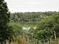 Balgavies Loch - geograph.org.uk - 5218595.jpg 5,184 × 3,888; 6.09 MB
-
 Balgavies Loch - geograph.org.uk - 6352534.jpg 5,472 × 3,648; 6.69 MB
-
 Balgavies Loch Nature Reserve - geograph.org.uk - 6524556.jpg 1,024 × 684; 222 KB
-
 Balgavies Loch Wildlife Reserve - geograph.org.uk - 2630092.jpg 3,264 × 2,448; 5.77 MB
-
 Balglassie Farmhouse - geograph.org.uk - 5882733.jpg 5,184 × 3,888; 3.68 MB
-
 Balglassie House - geograph.org.uk - 5662038.jpg 640 × 427; 301 KB
-
 Barley near Pitkennedy - geograph.org.uk - 5882716.jpg 5,184 × 3,888; 5.64 MB
-
 Bellahill Farm - geograph.org.uk - 1125071.jpg 640 × 439; 79 KB
-
 Bellahill Farm - geograph.org.uk - 5882713.jpg 5,184 × 3,888; 6.14 MB
-
 Bellahill Farm - geograph.org.uk - 6577394.jpg 1,024 × 689; 126 KB
-
 Bench Mark, Woodend - geograph.org.uk - 2612554.jpg 480 × 640; 88 KB
-
 Bittersweet Nightshade - geograph.org.uk - 6557199.jpg 1,024 × 738; 88 KB
-
 Brechin Pump Station - geograph.org.uk - 5936375.jpg 2,282 × 3,598; 1.49 MB
-
 Broadfaulds - geograph.org.uk - 4803451.jpg 800 × 600; 200 KB
-
 Broadfaulds Farm - geograph.org.uk - 2508970.jpg 3,456 × 2,304; 1.41 MB
-
 Broomknowe - geograph.org.uk - 4805756.jpg 800 × 600; 132 KB
-
 Broomknowe Farm - geograph.org.uk - 1810929.jpg 3,442 × 2,282; 1.79 MB
-
 Broomknowe Farm - geograph.org.uk - 5016204.jpg 4,463 × 3,347; 2.87 MB
-
 Broomknowe Farm from the B9134 - geograph.org.uk - 4603276.jpg 640 × 481; 45 KB
-
 Bull - geograph.org.uk - 6743297.jpg 1,024 × 683; 225 KB
-
 Burdock - geograph.org.uk - 6568543.jpg 1,024 × 711; 134 KB
-
 C43 (Angus) road, in Montreathmont Forest - geograph.org.uk - 6640078.jpg 5,184 × 3,888; 3.19 MB
-
 C44 (Angus) road - geograph.org.uk - 6628377.jpg 5,184 × 3,888; 4.79 MB
-
 Cairn, Carsegownie - geograph.org.uk - 4808381.jpg 800 × 600; 206 KB
-
 Calocera viscosa - geograph.org.uk - 2630384.jpg 3,264 × 2,448; 4.59 MB
-
 Carsegownie - geograph.org.uk - 6544471.jpg 1,024 × 683; 101 KB
-
 Carsegownie Farm near Forfar - geograph.org.uk - 976653.jpg 640 × 426; 45 KB
-
 Carsegownie Farm Road - geograph.org.uk - 1125063.jpg 640 × 383; 71 KB
-
 Carsegownie Farm Road - geograph.org.uk - 4603302.jpg 640 × 481; 60 KB
-
 Cherub - geograph.org.uk - 6570237.jpg 1,024 × 768; 341 KB
-
 Class I Pictish symbol stone at Aberlemno - geograph.org.uk - 6706773.jpg 1,600 × 1,082; 814 KB
-
 Class II Pictish symbol stone in Aberlemno churchyard - geograph.org.uk - 6706788.jpg 1,600 × 1,200; 1.4 MB
-
 Class II Pictish symbol stone in Aberlemno churchyard - geograph.org.uk - 6706803.jpg 1,600 × 1,120; 1.37 MB
-
 Coots - geograph.org.uk - 6521533.jpg 1,024 × 642; 129 KB
-
 Cotton of Turin - geograph.org.uk - 3813803.jpg 640 × 426; 272 KB
-
 Crook Hill - geograph.org.uk - 1125122.jpg 640 × 427; 66 KB
-
 Crook Hill - geograph.org.uk - 2692305.jpg 640 × 481; 67 KB
-
 Crook Hill - geograph.org.uk - 5662011.jpg 640 × 427; 290 KB
-
 Crook Hill - geograph.org.uk - 5662018.jpg 640 × 427; 326 KB
-
 Crook Hill - geograph.org.uk - 5662019.jpg 640 × 427; 341 KB
-
 Crook Hill - geograph.org.uk - 6626344.jpg 5,184 × 3,888; 4.28 MB
-
 Cross Slab, Aberlemno - geograph.org.uk - 2927185.jpg 1,680 × 2,520; 650 KB
-
 Cross Slab, Aberlemno - geograph.org.uk - 5182400.jpg 5,184 × 3,888; 5.03 MB
-
 Crossroads, Montreathmont Forest - geograph.org.uk - 3813790.jpg 640 × 480; 303 KB
-
 Crosston - geograph.org.uk - 6577371.jpg 1,024 × 683; 201 KB
-
 Crosston School, Aberlemno - geograph.org.uk - 5016294.jpg 4,597 × 3,447; 3.44 MB
-
 Cygnet at Balgavies Loch - geograph.org.uk - 6364098.jpg 1,024 × 683; 82 KB
-
 Derelict Broonknowe Cottages - geograph.org.uk - 1810915.jpg 3,456 × 2,304; 1.78 MB
-
 Derelict Farm Buildings - geograph.org.uk - 1125108.jpg 640 × 426; 63 KB
-
 Drystane Dyke and Ploughed Land - geograph.org.uk - 5662071.jpg 640 × 427; 339 KB
-

-
 East Gate - geograph.org.uk - 6742376.jpg 1,024 × 683; 335 KB
-
 Enjoying the Sun - geograph.org.uk - 6567722.jpg 1,024 × 672; 148 KB
-
 Fallen larch at Balgavies Loch - geograph.org.uk - 2630386.jpg 3,264 × 2,448; 6.11 MB
-
 Farm Buildings - geograph.org.uk - 6577259.jpg 1,024 × 683; 127 KB
-
 Farm buildings at Fordmouth - geograph.org.uk - 6594109.jpg 5,184 × 3,888; 5.98 MB
-
 Farm equipment at Easterton of Melgund - geograph.org.uk - 5882721.jpg 5,184 × 3,888; 5.3 MB
-
 Farm road to Wood of Auldbar - geograph.org.uk - 3232710.jpg 1,200 × 797; 323 KB
-
 Farm track across Melgund Muir - geograph.org.uk - 3232713.jpg 1,200 × 797; 402 KB
-
 Field by the South Esk - geograph.org.uk - 907476.jpg 640 × 480; 94 KB
-
 Field near Melgund - geograph.org.uk - 5662023.jpg 640 × 427; 366 KB
-

-
 Field Scabious (Knautia arvensis) - geograph.org.uk - 6539740.jpg 1,024 × 768; 58 KB
-
 Fields at Balgarrock - geograph.org.uk - 5662056.jpg 640 × 427; 387 KB
-
 Fields at the foot of Turin Hill - geograph.org.uk - 6590920.jpg 5,184 × 3,888; 5.29 MB
-
 Fields on the flood plain of the River South Esk - geograph.org.uk - 3266049.jpg 1,200 × 797; 546 KB
-
 Fields, Westerton - geograph.org.uk - 3812669.jpg 640 × 426; 246 KB
-
 Flemington farmstead, Aberlemno - geograph.org.uk - 5016270.jpg 4,608 × 3,456; 3.38 MB
-
 Fly Agaric at Balgavies Loch - geograph.org.uk - 6364137.jpg 1,024 × 683; 124 KB
-
 Flying the Flag - geograph.org.uk - 6611507.jpg 1,024 × 683; 59 KB
-
 Font, Aberlemno Kirk - geograph.org.uk - 1859640.jpg 480 × 640; 92 KB
-
 Footpath to Auldbar Dam - geograph.org.uk - 939194.jpg 640 × 427; 91 KB
-
 Forestry road in Montreathmont Forest - geograph.org.uk - 3232718.jpg 1,200 × 797; 626 KB
-

-
 From the slopes of Hill of Finavon - geograph.org.uk - 2370811.jpg 800 × 600; 150 KB
-
 Gated forestry track in Montreathmont Forest - geograph.org.uk - 3232722.jpg 1,200 × 797; 592 KB
-
 Gatepost, Howmuir - geograph.org.uk - 4808386.jpg 800 × 600; 187 KB
-
 Going Wild - geograph.org.uk - 6547566.jpg 1,024 × 683; 261 KB
-
 Green field overlooking Strathmore - geograph.org.uk - 5882743.jpg 5,184 × 3,888; 6.5 MB
-
 Green Tractor - geograph.org.uk - 6607929.jpg 1,024 × 683; 73 KB
-
 Grey Heron - geograph.org.uk - 6552256.jpg 1,024 × 602; 193 KB
-
 Grey Heron - geograph.org.uk - 6603051.jpg 1,024 × 723; 116 KB
-
 Haugh Land at Balgarrock - geograph.org.uk - 5662053.jpg 640 × 427; 339 KB
-
 Hay bales, Hillbarns Farm - geograph.org.uk - 5224067.jpg 5,184 × 3,888; 4.85 MB
-
 Heilan Coos Balgavies Loch - geograph.org.uk - 6363683.jpg 1,024 × 683; 239 KB
-
 Henwell Burn at Aberlemno - geograph.org.uk - 4593581.jpg 640 × 480; 100 KB
-
 Henwellburn - geograph.org.uk - 4808208.jpg 800 × 600; 225 KB
-
 Hill of Finavon Road - geograph.org.uk - 5833929.jpg 5,184 × 3,888; 7.11 MB
-
 Hillbarns Entrance - geograph.org.uk - 1810907.jpg 3,456 × 2,304; 2.26 MB
-
 Houses near Balgarrock - geograph.org.uk - 5662047.jpg 640 × 427; 323 KB
-
 Ivy on Wall - geograph.org.uk - 6526951.jpg 1,024 × 577; 207 KB
-
 Kirkton Bridge - geograph.org.uk - 1811091.jpg 3,412 × 2,236; 1.84 MB
-
 Kirkton Bridge at Aberlemno - geograph.org.uk - 4593584.jpg 640 × 480; 101 KB
-

-
 Logging road, Montreathmont Forest - geograph.org.uk - 3813780.jpg 640 × 480; 310 KB
-
 Logging road, Montreathmont Forest - geograph.org.uk - 3813782.jpg 640 × 480; 282 KB
-
 Logging road, Montreathmont Forest - geograph.org.uk - 3813785.jpg 640 × 480; 280 KB
-
 Logging road, Montreathmont Forest - geograph.org.uk - 4803467.jpg 600 × 800; 263 KB
-
 Long Shadows - geograph.org.uk - 5662059.jpg 640 × 427; 336 KB
-
 Mains of Balgavies - geograph.org.uk - 5841571.jpg 5,184 × 3,888; 5.86 MB
-
 Mains of Melgund - geograph.org.uk - 5662024.jpg 640 × 427; 400 KB
-
 Mains of Melgund Farm - geograph.org.uk - 976725.jpg 640 × 426; 59 KB
-
 Manure and stubble, Carsegownie - geograph.org.uk - 4808337.jpg 800 × 600; 204 KB
-
 Melgund Burn - geograph.org.uk - 1811124.jpg 2,304 × 3,456; 2.77 MB
-
 Melgund Burn at Aberlemno - geograph.org.uk - 4593575.jpg 640 × 480; 105 KB
-
 Melgund Burn, Aberlemno - geograph.org.uk - 1859644.jpg 480 × 640; 194 KB
-
 Melgund Castle - geograph.org.uk - 5882726.jpg 5,184 × 3,888; 5.5 MB
-
 Mildens Crossing - geograph.org.uk - 4803441.jpg 800 × 600; 210 KB
-
 Minor road at Balbinny - geograph.org.uk - 3266057.jpg 1,200 × 797; 476 KB
-
 Minor road at Pitkennedy - geograph.org.uk - 3232707.jpg 1,200 × 797; 620 KB
-
 Minor road at Wood of Auldbar - geograph.org.uk - 3232712.jpg 1,200 × 797; 517 KB
-
 Minor road near Balgarrock - geograph.org.uk - 3266055.jpg 1,200 × 797; 607 KB
-
 Minor road near Balgarrock - geograph.org.uk - 3266056.jpg 1,200 × 797; 567 KB
-
 Minor road near Balglassie Farm - geograph.org.uk - 3266052.jpg 1,200 × 797; 673 KB
-
 Minor road near Netherton - geograph.org.uk - 3266050.jpg 1,200 × 797; 637 KB
-
 Minor road through Montreathmont Forest - geograph.org.uk - 3232725.jpg 1,200 × 797; 533 KB
-
 Montreathmont Forest - geograph.org.uk - 3813774.jpg 640 × 480; 353 KB
-
 Montreathmont Forest - geograph.org.uk - 3813798.jpg 640 × 426; 324 KB
-
 Montreathmont Forest - geograph.org.uk - 3815726.jpg 640 × 480; 362 KB
-
 Montreathmont Forest - geograph.org.uk - 4803461.jpg 800 × 600; 228 KB
-
 Myrestone - geograph.org.uk - 4808429.jpg 800 × 600; 143 KB
-
 Near Balbinny - geograph.org.uk - 5662066.jpg 640 × 427; 294 KB
-
 Near Netherton - geograph.org.uk - 5662028.jpg 640 × 427; 339 KB
-
 Nether Turin Farm - geograph.org.uk - 1098089.jpg 640 × 428; 54 KB
-
 Nether Turin Farm - geograph.org.uk - 5841567.jpg 5,184 × 3,888; 5.05 MB
-
 Netherton - geograph.org.uk - 4805795.jpg 800 × 600; 183 KB
-
 Netherton Farm - geograph.org.uk - 4603281.jpg 640 × 481; 58 KB
-
 New House at Damside - geograph.org.uk - 5662062.jpg 640 × 427; 352 KB
-
 New House at Netherton - geograph.org.uk - 5662030.jpg 640 × 427; 324 KB
-
 New House of Balgavies - geograph.org.uk - 6583831.jpg 1,024 × 683; 216 KB
-
 New Houses at Balbinny - geograph.org.uk - 5662063.jpg 640 × 427; 288 KB
-
 New Year's Day - geograph.org.uk - 6357575.jpg 5,317 × 3,545; 4.04 MB
-
 Oak Tree - geograph.org.uk - 6363114.jpg 1,024 × 683; 147 KB
-
 Old Station Auldbar - geograph.org.uk - 6357591.jpg 1,024 × 682; 241 KB
-
 Path at Balgavies Loch - geograph.org.uk - 2630446.jpg 3,264 × 2,448; 5.47 MB
-
 Pheasant fight, Mains of Balgavies - geograph.org.uk - 3811800.jpg 640 × 426; 296 KB
-
 Pictish Cross Slab at Aberlemno - geograph.org.uk - 4592494.jpg 640 × 480; 50 KB
-

-
 Pictish scene at Abelemno - geograph.org.uk - 1810887.jpg 2,226 × 3,406; 1.28 MB
-
 Pictish Standing Stone, Aberlemno - geograph.org.uk - 3890146.jpg 417 × 640; 101 KB
-
 Pictish Standing Stone, Aberlemno - geograph.org.uk - 3890384.jpg 415 × 640; 53 KB
-
 Pictish Standing Stone, Aberlemno - geograph.org.uk - 4236992.jpg 1,199 × 1,799; 362 KB
-
 Pictish Stone - geograph.org.uk - 6577381.jpg 1,024 × 645; 121 KB
-
 Pinegrove Croft - geograph.org.uk - 2508991.jpg 3,456 × 2,304; 1.24 MB
-
 Pipeline Markers - geograph.org.uk - 5662049.jpg 640 × 427; 531 KB
-

-
 Pitkennedy - geograph.org.uk - 3813810.jpg 640 × 426; 305 KB
-
 Pitkennedy - geograph.org.uk - 3815732.jpg 640 × 426; 247 KB
-
 Pitkennedy - geograph.org.uk - 6608118.jpg 1,024 × 683; 139 KB
-

-
 Pitkennedy Farm - geograph.org.uk - 5882718.jpg 5,184 × 3,888; 4.85 MB
-
 Pitkennedy Farm - geograph.org.uk - 976742.jpg 640 × 426; 63 KB
-
 Pitkennedy School - geograph.org.uk - 976811.jpg 640 × 426; 73 KB
-
 Ploughed Fields - geograph.org.uk - 1810901.jpg 3,400 × 2,216; 1.66 MB


_road,_in_Montreathmont_Forest_-_geograph.org.uk_-_6640078.jpg)
_road_-_geograph.org.uk_-_6628377.jpg)


_-_geograph.org.uk_-_6539740.jpg)


&filefrom=Ploughed+Land+-+geograph.org.uk+-+5662015.jpg#mw-category-media)