Category:21st-century maps of Ontario
Jump to navigation
Jump to search
Provinces and territories of Canada: Alberta · New Brunswick · Newfoundland and Labrador · Nova Scotia · Ontario · Prince Edward Island · Quebec · Saskatchewan · Northwest Territories · Nunavut · Yukon
Subcategories
This category has the following 4 subcategories, out of 4 total.
Media in category "21st-century maps of Ontario"
The following 4 files are in this category, out of 4 total.
-
 Ont2003.PNG 1,088 × 2,040; 31 KB
-
 Ontario 2007 Referendum Map 01.svg 3,130 × 1,922; 4.28 MB
-
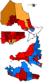
 Ontario Provincial Election, 2003 - Results By Riding.svg 1,967 × 1,476; 426 KB
-
 Ottawa2006.PNG 530 × 390; 6 KB


