Category:21st-century maps of Alberta
Jump to navigation
Jump to search
Provinces and territories of Canada: Alberta · New Brunswick · Newfoundland and Labrador · Nova Scotia · Ontario · Prince Edward Island · Quebec · Saskatchewan · Northwest Territories · Nunavut · Yukon
Subcategories
This category has the following 2 subcategories, out of 2 total.
Media in category "21st-century maps of Alberta"
The following 7 files are in this category, out of 7 total.
-
 2023 Alberta General Election Map.svg 1,460 × 1,479; 4.53 MB
-
 Alberta Election Map 2015.svg 1,154 × 1,362; 323 KB
-
 Alberta regions 2019.svg 635 × 1,032; 943 KB
-
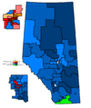 Alta2004.PNG 1,088 × 1,300; 29 KB
-
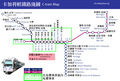 C-Train Map Chi.png 934 × 628; 73 KB
-
 C-Train Map.png 934 × 544; 71 KB
-
 Calgary City Council, 2017 by ward.png 729 × 1,069; 29 KB


