Category:20th-century maps of Saxony
Jump to navigation
Jump to search
Federal states of Germany:
Subcategories
This category has the following 6 subcategories, out of 6 total.
- 1990s maps of Saxony (3 F)
- 20th-century maps of Dresden (56 F)
Media in category "20th-century maps of Saxony"
The following 3 files are in this category, out of 3 total.
-
 Heilstätte Carolagrün in einer Landkarte aus dem Anfang des 20. Jahrhunderts.jpg 2,991 × 2,226; 3.44 MB
-
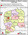 Bezirk Leipzig 1989.png 952 × 1,185; 248 KB
-
 Sachsen Kreis- u Amts-Einteilung 1900–1932.gif 1,706 × 996; 658 KB


