Category:2016 North Carolina election maps
Jump to navigation
Jump to search
States of the United States: Arizona · California · Colorado · Illinois · Iowa · Kentucky · Michigan · New York · North Carolina · Ohio · Pennsylvania · South Carolina
Subcategories
This category has only the following subcategory.
Media in category "2016 North Carolina election maps"
The following 17 files are in this category, out of 17 total.
-
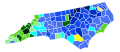
 2016 NC Pres state senate results.svg 810 × 315; 506 KB
-
 2016 NC state senate results.svg 1,200 × 450; 507 KB
-
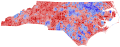
 2016 North Carolina gubernatorial election results map by county.svg 810 × 316; 80 KB
-
-

-
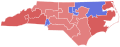
 2016NCGovernorByCongressionalDistrict.svg 810 × 316; 154 KB
-
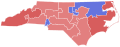
 2016NCLtGovernorByCongressionalDistrict.svg 810 × 316; 155 KB
-
 2016NCSenatorrByCongressionalDistrict.svg 810 × 316; 155 KB
-
 NC 2016 Pres.svg 810 × 316; 26.42 MB
-
 NC 2016 Senate.svg 810 × 316; 26.42 MB
-
 NC Attorney General 2016.svg 810 × 316; 26.42 MB
-
 NC Governor 2016.svg 810 × 316; 26.42 MB
-
 NC Lieutenant Governor 2016.svg 810 × 316; 26.42 MB
-
 NC Lieutenent gubernatorial election, 2016.svg 810 × 316; 80 KB
-
 North Carolina Attorney General election results by county, 2016.svg 810 × 316; 80 KB
-
 North Carolina Democratic Gubernatorial Primary 2016.svg 810 × 316; 80 KB
-
 NorthCarolina2016HouseofRepsElection.svg 810 × 316; 155 KB
