
Category:2014 maps of Germany
Federal states of Germany:
Hamburg · Hesse · Lower Saxony · North Rhine-Westphalia · Saarland · Saxony · Saxony-Anhalt · Thuringia
Subcategories
This category has the following 10 subcategories, out of 10 total.
'
- 2014 maps of Hamburg (2 F)
- 2014 maps of Hesse (2 F)
- 2014 maps of Saarland (1 F)
Media in category "2014 maps of Germany"
The following 22 files are in this category, out of 22 total.
-
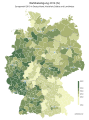
 Bevölkerungsentwicklung abzüglich der Geburtenbilanz 2011-2014.svg 946 × 1,253; 647 KB
-
 Bevölkerungsentwicklung abzüglich der Geburtenbilanz 2013-2014.svg 946 × 1,253; 647 KB
-
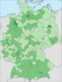
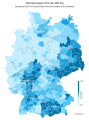
 Bevölkerungsentwicklung Kreisebene 2011-2014.svg 946 × 1,253; 701 KB
-
 Bevölkerungsentwicklung Kreisebene 2013-2014.svg 946 × 1,253; 703 KB
-
 ECDM 20140429 World Events.pdf 1,625 × 1,125; 472 KB
-
 ECDM 20140610 Europe SevereWeather.pdf 1,625 × 1,125; 503 KB
-
 ECDM 20140730 Europe SevereWeather.pdf 1,625 × 1,125; 396 KB
-
 ECDM 20141023 Europe SevereWeather.pdf 1,625 × 1,125; 659 KB
-
 ECDM NorthernEurope SevereWeather 20141022.pdf 1,625 × 1,125; 450 KB
-
 ECHO Germany Editable A4 Landscape.pdf 1,754 × 1,239; 313 KB
-
 ECHO Germany Editable A4 Landscape.png 1,123 × 794; 292 KB
-
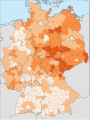
 Stimmenanteil der FDP 2014.svg 560 × 750; 1.27 MB
-
 Geburtenbilanz Kreisebene 2014.svg 946 × 1,253; 647 KB
-
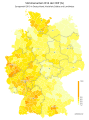
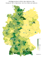
 Geburtenrate Deutschland 2014.svg 946 × 1,253; 647 KB
-
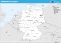
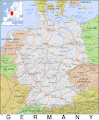
 Germany Base Map.png 1,106 × 699; 301 KB
-
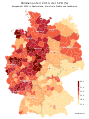
 Gestorbene Kreisebene 2014.svg 946 × 1,253; 647 KB
-
 PAT - Germany.gif 830 × 1,010; 294 KB
-
 Stimmenanteil der AfD 2014.svg 560 × 750; 1.27 MB
-
 Stimmenanteil der GRÜNEN 2014.svg 560 × 750; 1.27 MB
-
 Stimmenanteil der LINKEN 2014.svg 560 × 750; 1.27 MB
-
 Stimmenanteil der SPD 2014.svg 560 × 750; 1.27 MB
-
 Wahlbeteiligung 2014.svg 560 × 750; 1.27 MB


