Category:2020 maps of Germany
Appearance
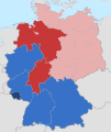
Federal states of Germany:
Subcategories
This category has the following 12 subcategories, out of 12 total.
'
- 2020 maps of Bavaria (3 F)
- 2020 maps of Bremen (state) (empty)
- 2020 maps of Hesse (2 F)
- 2020 maps of Saarland (1 F)
Media in category "2020 maps of Germany"
The following 18 files are in this category, out of 18 total.
-
90 year olds and older in German districts 2020.svg 946 × 1,253; 647 KB
-
Bevölkerungsdichte Deutschland 2020.svg 946 × 1,253; 696 KB
-
Bevölkerungsentwicklung abzüglich der Geburtenbilanz 2017-2020.svg 946 × 1,253; 647 KB
-
Bevölkerungsentwicklung abzüglich der Geburtenbilanz 2019-2020.svg 946 × 1,253; 702 KB
-
Bevölkerungsentwicklung Kreisebene 2017-2020.svg 946 × 1,253; 711 KB
-
Bevölkerungsentwicklung Kreisebene 2019-2020.svg 946 × 1,253; 703 KB
-
BIP je Einwohner auf Kreisebene 2020.svg 946 × 1,253; 653 KB
-
BIP je Erwerbstätigen Kreisebene 2020.svg 946 × 1,253; 653 KB
-
BIP Veränderung Kreisebene 2019-2020.svg 946 × 1,253; 653 KB
-
Durchschnittsalter Kreisebene 2020.svg 946 × 1,253; 647 KB
-
Geburtenbilanz Kreisebene 2020.svg 946 × 1,253; 688 KB
-
Geburtenrate Deutschland 2020.svg 946 × 1,253; 682 KB
-
German states by fertility rate.png 5,825 × 6,465; 1.07 MB
-
Geschlechterverteilung 18-29 2020.svg 946 × 1,253; 693 KB
-
Geschlechterverteilung 30-39 2020.svg 946 × 1,253; 694 KB
-
Gestorbene Kreisebene 2020.svg 946 × 1,253; 679 KB
-
Heat-Map 2020.png 2,360 × 1,286; 370 KB
-
Konfessionen-in-Deutschland-2020.svg 1,343 × 1,591; 642 KB


