Category:2010 maps of Greece
Jump to navigation
Jump to search
Media in category "2010 maps of Greece"
The following 11 files are in this category, out of 11 total.
-
 Greece - DPLA - 1871053cb93e312ae166639731081db5.jpg 2,550 × 3,264; 6.32 MB
-
 Greece- Physiography - DPLA - fcc2308ff465229cd0e7a12105e1b1a3.jpg 2,558 × 3,276; 6.63 MB
-
 2010 Dimos Megareon.svg 1,199 × 798; 51 KB
-
 2010 Dimos Tembon.svg 1,118 × 1,490; 45 KB
-
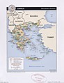
 Greece Transportation.jpg 2,008 × 2,673; 1.4 MB
-
 Greece, administrative divisions. LOC 2010588795.jpg 3,341 × 4,335; 1.44 MB
-
 Greece, administrative divisions. LOC 2010588795.tif 3,341 × 4,335; 41.44 MB
-
 Greece, physiography. LOC 2010588794.jpg 3,380 × 4,350; 1.83 MB
-
 Greece, physiography. LOC 2010588794.tif 3,380 × 4,350; 42.07 MB
-
 Greece. LOC 2010588793.jpg 3,344 × 4,293; 1.72 MB
-
 Greece. LOC 2010588793.tif 3,344 × 4,293; 41.07 MB


