Category:2010 maps of Switzerland
Jump to navigation
Jump to search
Cantons of Switzerland:
Subcategories
This category has only the following subcategory.
Media in category "2010 maps of Switzerland"
The following 56 files are in this category, out of 56 total.
-
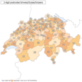 2 digit postcode switzerland.png 885 × 885; 117 KB
-
 Axpo Super League 2009-10.png 1,500 × 989; 296 KB
-
 Challenge League 2009-10.png 1,500 × 989; 363 KB
-
 Karte Bezirke der Schweiz 2010 11 21.png 4,133 × 2,848; 2.42 MB
-
 Karte Bezirke der Schweiz 2010.png 4,133 × 2,848; 2.42 MB
-
 Karte Bezirke der Schweiz farbig 2010 11 21.png 4,133 × 2,848; 2.85 MB
-
 Karte Bezirke der Schweiz farbig 2010.png 4,133 × 2,848; 2.85 MB
-
 Karte Bezirke und Kreise der Schweiz 2010 11 21.png 4,133 × 2,848; 2.54 MB
-
 Karte Bezirke und Kreise der Schweiz 2010.png 4,133 × 2,848; 2.54 MB
-
 Karte Bezirke und Kreise der Schweiz farbig 2010 11 21.png 4,133 × 2,848; 3.09 MB
-
 Karte Bezirke und Kreise der Schweiz farbig 2010.png 4,133 × 2,848; 3.09 MB
-
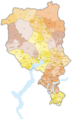
 Karte Espace Mittelland 2010.png 4,133 × 2,770; 3.5 MB
-
 Karte Gemeinden der Schweiz 2010.01.01.png 4,133 × 2,848; 3.71 MB
-
 Karte Gemeinden der Schweiz 2010.04.25.png 4,133 × 2,848; 3.71 MB
-
 Karte Gemeinden der Schweiz 2010.11.21.png 4,133 × 2,848; 3.71 MB
-
 Karte Gemeinden der Schweiz 2010.png 4,133 × 2,770; 3.41 MB
-
 Karte Gemeinden des Kantons Aargau farbig 2010.png 2,952 × 2,820; 2.25 MB
-
 Karte Gemeinden des Kantons Bern farbig 2010.png 2,952 × 2,446; 2.02 MB
-
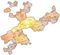
 Karte Gemeinden des Kantons Graubünden farbig 2010.png 3,836 × 2,751; 2.33 MB
-
 Karte Gemeinden des Kantons Luzern farbig 2010.png 2,951 × 2,972; 1.57 MB
-
 Karte Gemeinden des Kantons Solothurn farbig 2010.png 2,952 × 2,703; 2 MB
-
 Karte Gemeinden des Kantons St. Gallen farbig 2010.png 2,952 × 3,400; 1.47 MB
-
 Karte Gemeinden des Kantons Tessin farbig 2010 2.png 1,771 × 2,926; 1.3 MB
-
 Karte Gemeinden des Kantons Tessin farbig 2010.png 1,771 × 2,926; 1.31 MB
-
 Karte Genferseeregion 2010.png 4,133 × 2,770; 3.45 MB
-
 Karte Grossregionen der Schweiz 2010.png 4,133 × 2,770; 3.63 MB
-
 Karte Lage Kanton Aargau 2010.png 4,133 × 2,770; 3.44 MB
-
 Karte Lage Kanton Basel Landschaft 2010.png 4,133 × 2,770; 3.42 MB
-
 Karte Lage Kanton Basel Stadt 2010.png 4,133 × 2,770; 3.41 MB
-
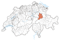
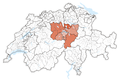
 Karte Lage Kanton Bern 2010.png 4,133 × 2,770; 3.47 MB
-
 Karte Lage Kanton Freiburg 2010.png 4,133 × 2,770; 3.44 MB
-
 Karte Lage Kanton Genf 2010.png 4,133 × 2,770; 3.42 MB
-
 Karte Lage Kanton Glarus 2010.png 4,133 × 2,770; 3.42 MB
-
 Karte Lage Kanton Graubünden 2010.png 4,133 × 2,770; 3.48 MB
-
 Karte Lage Kanton Jura 2010.png 4,133 × 2,770; 3.42 MB
-
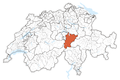
 Karte Lage Kanton Luzern 2010.png 4,133 × 2,770; 3.43 MB
-
 Karte Lage Kanton Nidwalden 2010.png 4,133 × 2,770; 3.42 MB
-
 Karte Lage Kanton Obwalden 2010.png 4,133 × 2,770; 3.42 MB
-
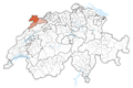
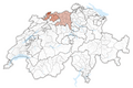
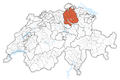
 Karte Lage Kanton Schaffhausen 2010.png 4,133 × 2,770; 3.42 MB
-
 Karte Lage Kanton Schwyz 2010.png 4,133 × 2,770; 3.42 MB
-
 Karte Lage Kanton Tessin 2010.png 4,133 × 2,770; 3.43 MB
-
 Karte Lage Kanton Thurgau 2010.png 4,133 × 2,770; 3.42 MB
-
 Karte Lage Kanton Uri 2010.png 4,133 × 2,770; 3.42 MB
-
 Karte Lage Kanton Waadt 2010.png 4,133 × 2,770; 3.45 MB
-
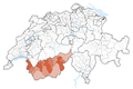 Karte Lage Kanton Wallis 2010.png 4,133 × 2,770; 3.43 MB
-
 Karte Lage Kanton Zug 2010.png 4,133 × 2,770; 3.42 MB
-
 Karte Lage Kanton Zürich 2010.png 4,133 × 2,770; 3.44 MB
-
 Karte Nordwestschweiz 2010.png 4,133 × 2,770; 2.06 MB
-
 Karte Ostschweiz 2010.png 4,133 × 2,770; 3.49 MB
-
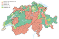 Karte Religionen der Schweiz 2010.png 4,133 × 2,770; 3.55 MB
-
 Karte Schweizer Sprachgebiete 2010.png 4,133 × 2,770; 3.55 MB
-
 Karte Tessin 2010.png 4,133 × 2,770; 3.44 MB
-
 Karte Zentralschweiz 2010.png 4,133 × 2,770; 3.45 MB
-
 Karte Zürich 2010.png 4,133 × 2,770; 3.44 MB
-
 Postleitzahlen Schweiz 1level klein.png 800 × 604; 63 KB
-
 Postleitzahlen Schweiz 2level klein.png 800 × 605; 118 KB


