Category:2009 in South Cave
Jump to navigation
Jump to search
Media in category "2009 in South Cave"
The following 52 files are in this category, out of 52 total.
-
 All Saints Church - geograph.org.uk - 1601865.jpg 640 × 480; 91 KB
-
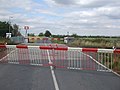 Broomfleet Level Crossing - geograph.org.uk - 1466213.jpg 640 × 480; 62 KB
-
 Broomfleet Signal Box.jpg 640 × 480; 60 KB
-
 Brough Road, South Cave (A1034) - geograph.org.uk - 1602181.jpg 640 × 480; 88 KB
-
 Can you hear me^ - geograph.org.uk - 1371929.jpg 640 × 480; 38 KB
-
 Castle Drive, South Cave - geograph.org.uk - 1601859.jpg 640 × 480; 59 KB
-
 Castle Farm Drewton.jpg 640 × 480; 49 KB
-
 Cave Common Farm - geograph.org.uk - 1217016.jpg 640 × 480; 77 KB
-
 Cave Common Farm from field path - geograph.org.uk - 1219731.jpg 640 × 480; 63 KB
-
 Church Street, South Cave - geograph.org.uk - 1477238.jpg 640 × 397; 47 KB
-
 Common Road - geograph.org.uk - 1603753.jpg 640 × 480; 44 KB
-
 Common Road, Broomfleet - geograph.org.uk - 1466219.jpg 640 × 480; 53 KB
-
 Crabley Creek Level Crossing - geograph.org.uk - 1466182.jpg 640 × 480; 77 KB
-
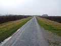 Crabley Lane - geograph.org.uk - 1603274.jpg 640 × 480; 61 KB
-
 Disused Farm Building, Ings Lane - geograph.org.uk - 1603282.jpg 640 × 480; 92 KB
-
 East Dale Footpath.jpg 480 × 640; 190 KB
-
 Entrance to Pinfold Lane - geograph.org.uk - 1368113.jpg 640 × 457; 83 KB
-
 Ferry Beck in a dry period - geograph.org.uk - 1216260.jpg 640 × 480; 84 KB
-
 Footpath over South Cave golf course - geograph.org.uk - 1216269.jpg 640 × 480; 80 KB
-
 Great Wold Trig point - geograph.org.uk - 1451944.jpg 640 × 480; 85 KB
-
 Heavy Goods on the A63 - geograph.org.uk - 1216302.jpg 640 × 480; 66 KB
-
 Hull Animal Welfare Trust - geograph.org.uk - 1368123.jpg 640 × 459; 65 KB
-
 Jarret Hill Lane - geograph.org.uk - 1603759.jpg 640 × 480; 72 KB
-
 Lake, South Cave - geograph.org.uk - 1601878.jpg 640 × 480; 81 KB
-
 Market Place, South Cave - geograph.org.uk - 1477241.jpg 640 × 480; 83 KB
-
 Middlebeck Bank - geograph.org.uk - 1466176.jpg 640 × 480; 54 KB
-
 Mill Beck - geograph.org.uk - 1603261.jpg 640 × 480; 86 KB
-
 Mill Beck heading south - geograph.org.uk - 1217009.jpg 640 × 480; 105 KB
-
 Mill Beck looking northwest - geograph.org.uk - 1216996.jpg 640 × 480; 91 KB
-
 Mill Farms across Mill Beck - geograph.org.uk - 1217000.jpg 640 × 480; 82 KB
-
 Newfield Lane - geograph.org.uk - 1601894.jpg 640 × 480; 75 KB
-
 On High Hunsley Wold - geograph.org.uk - 1451934.jpg 640 × 480; 126 KB
-
 Pond and Greenhouses - geograph.org.uk - 1603260.jpg 640 × 480; 77 KB
-
 Provence Farm - geograph.org.uk - 1466186.jpg 640 × 480; 52 KB
-
 Provence Gate and Ings Lane - geograph.org.uk - 1466183.jpg 640 × 480; 43 KB
-
 Pylons near Ings Lane - geograph.org.uk - 1603269.jpg 480 × 640; 38 KB
-
 Pylons off Ings Lane - geograph.org.uk - 1466179.jpg 640 × 480; 69 KB
-
 Radio masts over a sea of cereal - geograph.org.uk - 1451952.jpg 640 × 480; 85 KB
-
 Ruffhamfield Plantation - geograph.org.uk - 1216324.jpg 640 × 480; 72 KB
-
 Snowy track near Mount Airy - geograph.org.uk - 1360194.jpg 480 × 640; 129 KB
-
 South Cave Bowls Club - geograph.org.uk - 1601874.jpg 640 × 480; 112 KB
-
 South Cave looking north. - geograph.org.uk - 1640542.jpg 640 × 480; 61 KB
-
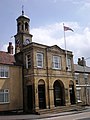
 South Cave Town Hall - geograph.org.uk - 1601851.jpg 480 × 640; 70 KB
-
 South Common Farm - geograph.org.uk - 1603765.jpg 640 × 480; 74 KB
-
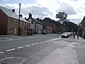
 Street Scene South Cave - geograph.org.uk - 1216275.jpg 640 × 480; 70 KB
-
 Swinescaif Road - geograph.org.uk - 1602176.jpg 640 × 480; 102 KB
-
 Telephone Exchange, Ferry Road - geograph.org.uk - 1601891.jpg 640 × 480; 78 KB
-
 The Bear, South Cave - geograph.org.uk - 1601846.jpg 640 × 480; 78 KB
-
 The track leading up Little Wold Side - geograph.org.uk - 1368168.jpg 640 × 480; 103 KB
-
 Town Hall South Cave.jpg 480 × 640; 61 KB
-
 West End, South Cave - geograph.org.uk - 1477233.jpg 640 × 480; 54 KB
-
 Woodland track in East Dale - geograph.org.uk - 1278456.jpg 480 × 640; 208 KB


_-_geograph.org.uk_-_1602181.jpg)


