Category:2006 in South Cave
Jump to navigation
Jump to search
Media in category "2006 in South Cave"
The following 64 files are in this category, out of 64 total.
-
 A View From Crabley Lane - geograph.org.uk - 247680.jpg 640 × 480; 107 KB
-
 A View From The Trans-Pennine Trail - geograph.org.uk - 217304.jpg 640 × 480; 103 KB
-
 All Saints Church Family Centre - geograph.org.uk - 229845.jpg 640 × 480; 139 KB
-
 All Saints Church Noticeboard - geograph.org.uk - 229854.jpg 640 × 480; 395 KB
-
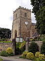 All Saints Church South Cave.jpg 480 × 640; 168 KB
-
 Brantingham Dale - geograph.org.uk - 174329.jpg 640 × 480; 138 KB
-
 Broomfleet Crossing - geograph.org.uk - 236029.jpg 640 × 426; 124 KB
-
 Cave Castle Entrance South Cave.jpg 640 × 480; 160 KB
-
 Chalkland Hills - geograph.org.uk - 133293.jpg 640 × 480; 128 KB
-
 Crabley Creek Level Crossing - geograph.org.uk - 247734.jpg 640 × 480; 110 KB
-
 Drewton.jpg 640 × 580; 121 KB
-
 Farmland South of the A63 - geograph.org.uk - 174911.jpg 640 × 480; 81 KB
-
 Footpath to The Warrens - geograph.org.uk - 187143.jpg 640 × 480; 36 KB
-
 Fox and Coney, South Cave - geograph.org.uk - 229098.jpg 640 × 543; 123 KB
-
 Heavy Mob Arriving - geograph.org.uk - 247721.jpg 640 × 480; 111 KB
-
 Hillside Copse - geograph.org.uk - 133291.jpg 640 × 480; 106 KB
-
 Little Wold Lane, South Cave - geograph.org.uk - 171087.jpg 640 × 480; 133 KB
-
 Little Wold Plantation - geograph.org.uk - 171116.jpg 640 × 480; 80 KB
-
 Looking North West from Rudstone Walk - geograph.org.uk - 235420.jpg 640 × 426; 123 KB
-
 May Blossom - geograph.org.uk - 174910.jpg 640 × 480; 115 KB
-
 Mill Beck - geograph.org.uk - 115334.jpg 640 × 480; 174 KB
-
 Mill Beck and Farm - geograph.org.uk - 115336.jpg 640 × 480; 186 KB
-
 More Mud Flats - geograph.org.uk - 247684.jpg 640 × 480; 100 KB
-
 Mount Airy - geograph.org.uk - 171121.jpg 640 × 480; 93 KB
-
 Mount Airy Farm - geograph.org.uk - 285407.jpg 640 × 480; 152 KB
-
 Near Common Farm - geograph.org.uk - 121388.jpg 640 × 480; 190 KB
-
 Newfield Lane - geograph.org.uk - 174909.jpg 640 × 480; 132 KB
-
 No Visible Turning - geograph.org.uk - 247780.jpg 640 × 480; 104 KB
-
 Old Chapel, Church Street - geograph.org.uk - 228979.jpg 640 × 480; 109 KB
-
 Pasture By The Estuary - geograph.org.uk - 247657.jpg 640 × 480; 102 KB
-
 Road from North Cave to the A1034 - geograph.org.uk - 187130.jpg 640 × 480; 35 KB
-
 Road Junction at SE880286 - geograph.org.uk - 115326.jpg 640 × 480; 97 KB
-
 Road Junction at SE91753015 - geograph.org.uk - 115350.jpg 640 × 480; 98 KB
-
 Road to Broomfleet - geograph.org.uk - 115331.jpg 640 × 480; 169 KB
-
 Road to Chalk Quarry - geograph.org.uk - 133285.jpg 640 × 480; 149 KB
-
 Rudstone Walk - geograph.org.uk - 236034.jpg 640 × 426; 117 KB
-
 Rudstone Walk hotel - geograph.org.uk - 235333.jpg 640 × 480; 101 KB
-
 South Cave - geograph.org.uk - 311539.jpg 640 × 371; 109 KB
-
 South Cave Market Place - geograph.org.uk - 311569.jpg 640 × 362; 90 KB
-
 South Cave Post Office - geograph.org.uk - 229000.jpg 640 × 480; 105 KB
-
 South Cave Post Office - geograph.org.uk - 229860.jpg 480 × 640; 140 KB
-
 South Cave Roll of Honour - geograph.org.uk - 229018.jpg 388 × 640; 100 KB
-
 South Cave Takeaway - geograph.org.uk - 229004.jpg 640 × 580; 147 KB
-
 South Cave Town Hall - geograph.org.uk - 228991.jpg 640 × 525; 98 KB
-
 South Cave War Memorial - geograph.org.uk - 228982.jpg 640 × 525; 177 KB
-
 South Cave, Bear Lodge - geograph.org.uk - 300505.jpg 640 × 478; 101 KB
-
 South Cave, Market Place - geograph.org.uk - 300662.jpg 640 × 468; 98 KB
-
 South Cave, West End - geograph.org.uk - 299251.jpg 640 × 480; 98 KB
-
 South Cave, West End - geograph.org.uk - 299256.jpg 640 × 480; 88 KB
-
 Straight And Narrow - geograph.org.uk - 247651.jpg 640 × 480; 107 KB
-
 SW of West End - geograph.org.uk - 115343.jpg 640 × 480; 132 KB
-
 Temporary Mud Flat Residents - geograph.org.uk - 247743.jpg 640 × 480; 105 KB
-
 The B1230 Climbing to The Wolds - geograph.org.uk - 187136.jpg 640 × 480; 40 KB
-

-
 The Bear, South Cave - geograph.org.uk - 229027.jpg 640 × 524; 107 KB
-
 The Cemetery Chapel, South Cave - geograph.org.uk - 299144.jpg 640 × 480; 101 KB
-
 The Iron Road - geograph.org.uk - 247730.jpg 640 × 480; 105 KB
-
 The Lane from Wold House Farm - geograph.org.uk - 187153.jpg 640 × 480; 39 KB
-
 The Stray - geograph.org.uk - 171129.jpg 640 × 480; 78 KB
-
 The Trans-Pennine Trail - geograph.org.uk - 217306.jpg 640 × 480; 110 KB
-
 The Trans-Pennine Trail On Crabley Lane - geograph.org.uk - 247649.jpg 640 × 480; 102 KB
-
 Vast Horizons - geograph.org.uk - 247804.jpg 640 × 480; 105 KB
-
 West End, South Cave - geograph.org.uk - 229838.jpg 640 × 480; 88 KB
-
 Willow Coppice - geograph.org.uk - 171133.jpg 640 × 480; 103 KB


