Category:2007 maps of Africa
Jump to navigation
Jump to search
Temperate regions: North America · South America · Africa · Europe · Asia · Oceania – Polar regions: – Other regions:
| ← 2000 2001 2002 2003 2004 2005 2006 2007 2008 2009 → |
Subcategories
This category has the following 2 subcategories, out of 2 total.
G
- 2007 maps of Ghana (2 F)
S
- 2007 maps of Sudan (4 F)
Media in category "2007 maps of Africa"
The following 28 files are in this category, out of 28 total.
-
 Africa - DPLA - 0d5d3b9e36550eb258b8ab12bb66ab10.jpg 2,125 × 2,637; 7.72 MB
-
 Africa - DPLA - 997136e458f49e013de89a74119d1e50.jpg 2,145 × 2,632; 7.21 MB
-
 Africa. LOC 2007626912.jpg 3,333 × 4,374; 1.81 MB
-
 Africa. LOC 2007626912.tif 3,333 × 4,374; 41.71 MB
-
 Africa. LOC 2007633529.jpg 2,559 × 3,323; 1.08 MB
-
 Africa. LOC 2007633529.tif 2,559 × 3,323; 24.33 MB
-
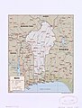
 Benin, administrative divisions. LOC 2007627112.jpg 2,487 × 3,283; 515 KB
-
 Benin. LOC 2007627110.jpg 2,490 × 3,278; 819 KB
-
 Benin. LOC 2007627110.tif 2,490 × 3,278; 23.35 MB
-
 Benin. LOC 2007627111.jpg 2,491 × 3,288; 735 KB
-
 Benin. LOC 2007627111.tif 2,491 × 3,288; 23.43 MB
-
 DakarRally2007PL.jpg 502 × 522; 67 KB
-
 Death-rate-from-opioid-use-who,Africa,2007.svg 850 × 600; 145 KB
-
 Death-rate-smoking,Africa,2007.svg 850 × 699; 146 KB
-
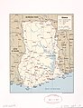
 Ghana administrative divisions. LOC 2008621521.jpg 3,300 × 4,386; 1.33 MB
-
 Ghana administrative divisions. LOC 2008621521.tif 3,300 × 4,386; 41.41 MB
-
 Ghana. LOC 2008621519.jpg 3,379 × 4,388; 1.56 MB
-
 Ghana. LOC 2008621519.tif 3,379 × 4,388; 42.42 MB
-
 Ghana. LOC 2008621520.jpg 3,357 × 4,386; 1.81 MB
-
 Ghana. LOC 2008621520.tif 3,357 × 4,386; 42.13 MB
-
 GSPC-karte.svg 1,000 × 700; 57 KB
-
 HDI Africa-IDH África 2007.png 373 × 348; 10 KB
-
 Petroleum regions - north Africa map-fr.svg 952 × 583; 78 KB
-
 Petroleum regions - West Africa map-es.svg 1,270 × 1,229; 147 KB
-
 Petroleum regions - West Africa map-fr.svg 1,270 × 1,229; 147 KB
-
 Un-south-africa.png 3,037 × 2,257; 1.87 MB
-
 « La grande roue » - l'Afrique et le monde.jpg 1,000 × 998; 1.21 MB
-
 خريطة فضالة 1942.jpg 4,369 × 4,779; 3.59 MB


