Category:2010 maps of Africa
Jump to navigation
Jump to search
Temperate regions: North America · South America · Africa · Europe · Asia · Oceania – Polar regions: – Other regions:
| ← 2010 2011 2012 2013 2014 2015 2016 2017 2018 2019 → |
Media in category "2010 maps of Africa"
The following 18 files are in this category, out of 18 total.
-
 2010 FIFA WC and ACN Qualified.png 341 × 341; 5 KB
-
 2010 Qualified.png 341 × 341; 6 KB
-
 Africa - DPLA - 1b1195329aec7c191574d04b3b346c72 (page 1).jpg 2,146 × 2,638; 7.29 MB
-
 Africa - DPLA - 1b1195329aec7c191574d04b3b346c72 (page 2).jpg 2,143 × 2,654; 7.21 MB
-
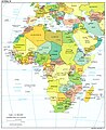 Africa - DPLA - 81bd787a021c9ea33f45ff8933d11dac.jpg 2,152 × 2,629; 6.04 MB
-
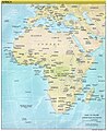
 Africa. LOC 2010587939.jpg 3,412 × 4,389; 1.36 MB
-
 Africa. LOC 2010587939.tif 3,412 × 4,389; 42.84 MB
-
 African Cup of 2010 Nations.png 677 × 681; 13 KB
-
 African-2010.png 677 × 681; 20 KB
-
 Botswana Defence Force, U.S. conducts joint military exercise (7629109996).jpg 1,100 × 1,552; 937 KB
-
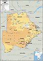
 Ichaboe map.png 594 × 749; 170 KB
-
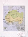
 Maghreb and Sahel - DPLA - d45bfd17f5a3bd99361c261ffbb27f4c.jpg 2,550 × 3,270; 5.67 MB
-
 Maghreb and Sahel. LOC 2010593832.jpg 3,358 × 4,369; 1.68 MB
-
 Maghreb and Sahel. LOC 2010593832.tif 3,358 × 4,369; 41.97 MB
-
 Middle East. LOC 2010585095.jpg 1,315 × 1,524; 808 KB
-
 Middle East. LOC 2010585095.tif 3,402 × 4,378; 42.61 MB
-
 Sao Tome map.png 907 × 1,157; 426 KB
-
 Tanzania, United Republic of Population Density, 2000 (5457627036).jpg 2,473 × 3,146; 645 KB


.jpg)
.jpg)


.jpg)


.jpg)