Category:2006 in the London Borough of Hackney
Jump to navigation
Jump to search
Boroughs of London: City of London · City of Westminster · Barking and Dagenham · Barnet · Bexley · Brent · Bromley · Camden · Croydon · Ealing · Enfield · Greenwich · Hackney · Hammersmith and Fulham · Haringey · Harrow · Havering · Hillingdon · Hounslow · Islington · Kensington and Chelsea · Kingston · Lambeth · Lewisham · Merton · Newham · Redbridge · Richmond · Southwark · Sutton · Tower Hamlets · Waltham Forest · Wandsworth
Media in category "2006 in the London Borough of Hackney"
The following 51 files are in this category, out of 51 total.
-

-
 Clapton Station - geograph.org.uk - 138336.jpg 480 × 640; 113 KB
-
 61 Gt Eastern St, Shoreditch, EC2A - geograph.org.uk - 141916.jpg 640 × 480; 326 KB
-
 Albion Road N16 - geograph.org.uk - 170546.jpg 640 × 480; 103 KB
-
 Behind Amhurst Road - geograph.org.uk - 287827.jpg 640 × 360; 76 KB
-

-
 Broadway market dove 1.jpg 640 × 489; 168 KB
-
 Cazenove Road, N16 - geograph.org.uk - 290202.jpg 640 × 480; 141 KB
-
 Christ Apostolic Church, Hackney.jpg 1,149 × 834; 882 KB
-
 Clapton Common - geograph.org.uk - 169787.jpg 640 × 480; 114 KB
-
 Clapton Common near Stamford Hill - geograph.org.uk - 169802.jpg 640 × 480; 115 KB
-
 Class War graffiti.jpg 640 × 295; 130 KB
-
 Clissold Park - panoramio - David Holt.jpg 1,600 × 1,200; 298 KB
-
 Clissold Park - panoramio.jpg 2,816 × 2,112; 2.12 MB
-
 Clissold Park London - panoramio (cropped).jpg 406 × 541; 131 KB
-
 Clissold Park London - panoramio.jpg 1,280 × 960; 361 KB
-
 Dalston dereliction 1.jpg 640 × 480; 187 KB
-
 De Beauvoir Estate (2) - geograph.org.uk - 171434.jpg 640 × 480; 104 KB
-
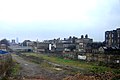 East London Line Extension site, Dalston - Flickr - Fin Fahey.jpg 1,280 × 858; 1.12 MB
-
 Eve libertine 2.jpg 640 × 480; 18 KB
-
 Hackney Marshes, London Borough of Hackney, E5 E9 (414929477).jpg 1,280 × 960; 334 KB
-
 Hackney old town hall - geograph.org.uk - 288280.jpg 640 × 480; 121 KB
-
 Haggerston iron church 1.jpg 544 × 640; 107 KB
-
 Haggerston Mosque - geograph.org.uk - 161385.jpg 640 × 480; 49 KB
-

-
 Homerton university hospital 1.jpg 640 × 401; 301 KB
-
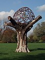
 Jesus of Suburbia (277239659).jpg 1,002 × 1,503; 1.07 MB
-
 Kingsland road railway bridge 2.jpg 640 × 480; 146 KB
-
 L'é buriana - Flickr - fabbio.jpg 2,265 × 3,228; 1.52 MB
-
 London class war.jpg 2,272 × 1,704; 918 KB
-
 Lower Clapton road - geograph.org.uk - 287839.jpg 640 × 361; 85 KB
-
 Please Hold your Breath - geograph.org.uk - 99330.jpg 640 × 480; 119 KB
-
 Pop^ goes the Weasel - geograph.org.uk - 244997.jpg 640 × 480; 99 KB
-
 Rubbish, Ashwin Street.jpg 3,008 × 2,000; 5.54 MB
-
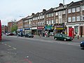
 Shops on Upper Clapton Road - geograph.org.uk - 138330.jpg 640 × 480; 97 KB
-
 Shoreditch blitz grave 1.jpg 640 × 480; 228 KB
-
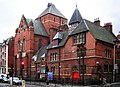
 Shoreditch library 1.jpg 640 × 488; 194 KB
-
 Stamford Hill N16 (2) - geograph.org.uk - 169796.jpg 640 × 480; 121 KB
-
 Stamford Hill railway station - geograph.org.uk - 167490.jpg 640 × 480; 109 KB
-
 Stoke newington fountain 1.jpg 480 × 640; 234 KB
-
 Stoke Newington geograph-4014838-by-Ben-Brooksbank.jpg 2,395 × 1,211; 3.62 MB
-
 Stoke newington lake 1.jpg 480 × 640; 146 KB
-
 Stoke newington lake 2.jpg 640 × 480; 184 KB
-
 Stoke newington st matthias 1.jpg 484 × 640; 344 KB
-
 Stoke newington town hall 2.jpg 640 × 501; 202 KB
-
 Stoke newington west reservoir 1.jpg 640 × 480; 99 KB
-
 Stoke newington west reservoir leisure centre 1.jpg 640 × 467; 157 KB
-

-
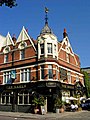 The Eagle, Shoreditch - geograph.org.uk - 244993.jpg 480 × 640; 90 KB
-
 Tiffin under the Linden Tree - geograph.org.uk - 287152.jpg 568 × 467; 66 KB
-
 Top of Mare street - geograph.org.uk - 288272.jpg 640 × 480; 88 KB


.jpg)


_-_geograph.org.uk_-_171434.jpg)


.jpg)


.jpg)


_-_geograph.org.uk_-_169796.jpg)


