
Category:2006 in the London Borough of Ealing
Boroughs of London: City of London · City of Westminster · Barking and Dagenham · Barnet · Bexley · Brent · Bromley · Camden · Croydon · Ealing · Enfield · Greenwich · Hackney · Hammersmith and Fulham · Haringey · Harrow · Havering · Hillingdon · Hounslow · Islington · Kensington and Chelsea · Kingston · Lambeth · Lewisham · Merton · Newham · Redbridge · Richmond · Southwark · Sutton · Tower Hamlets · Waltham Forest · Wandsworth
Subcategories
This category has the following 4 subcategories, out of 4 total.
Media in category "2006 in the London Borough of Ealing"
The following 122 files are in this category, out of 122 total.
-
 1912 houses, Horn Lane, North Acton - geograph.org.uk - 177939.jpg 640 × 480; 94 KB
-
 FGWL 166214 viewed from HST 01.jpg 1,600 × 1,200; 874 KB
-
 West Ealing (2006a).jpg 1,723 × 1,170; 469 KB
-
 West Ealing (2006b).jpg 1,723 × 1,170; 410 KB
-
 Acton cemetery - geograph.org.uk - 177865.jpg 640 × 480; 124 KB
-
 Acton Cemetery - geograph.org.uk - 177875.jpg 640 × 480; 117 KB
-
 Acton Main Line station - geograph.org.uk - 137846.jpg 640 × 480; 102 KB
-
 Aggregates at Acton goods yard - geograph.org.uk - 138801.jpg 640 × 480; 96 KB
-
 Aintree Road, Perivale - geograph.org.uk - 204306.jpg 640 × 480; 89 KB
-

-
 Alley - Sudbury Town - geograph.org.uk - 318610.jpg 480 × 640; 85 KB
-
 Allotments, Northfield Avenue W13 - geograph.org.uk - 116005.jpg 600 × 450; 212 KB
-

-
 Berkeley Fields - geograph.org.uk - 188754.jpg 640 × 480; 105 KB
-
 Bus stop on Western Avenue, North Acton - geograph.org.uk - 188095.jpg 640 × 480; 103 KB
-
 Cafe by Acton Mainline Station - geograph.org.uk - 138802.jpg 640 × 480; 79 KB
-

-
 Car wash, Horn Lane, North Acton - geograph.org.uk - 174602.jpg 640 × 480; 110 KB
-

-
 Cineworld Cinema, Ealing, W5 - geograph.org.uk - 250715.jpg 640 × 480; 306 KB
-
 Cloister Road Clinic, North Acton - geograph.org.uk - 139543.jpg 640 × 480; 97 KB
-

-
 District Line railway in Ealing - geograph.org.uk - 204510.jpg 640 × 480; 134 KB
-

-
 Drums and Ealing Jazz - geograph.org.uk - 271689.jpg 640 × 426; 117 KB
-
 Ealing Broadway Box.JPG 1,012 × 1,462; 306 KB
-
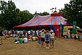
 Ealing Jazz Festival - geograph.org.uk - 271686.jpg 640 × 336; 111 KB
-
 Ealing Second Stage - geograph.org.uk - 271720.jpg 640 × 426; 126 KB
-
 Ealing Studios, Ealing W5 - geograph.org.uk - 251965.jpg 640 × 480; 265 KB
-

-
 Ealing, Haven Lane, W5 - geograph.org.uk - 141800.jpg 640 × 480; 80 KB
-
 Ealing, New Broadway, W5 - geograph.org.uk - 141767.jpg 640 × 480; 101 KB
-

-
 Electricity sub-station, North Acton - geograph.org.uk - 177938.jpg 640 × 480; 103 KB
-
 Elthorne Park Avenue, Hanwell - geograph.org.uk - 209510.jpg 640 × 422; 105 KB
-

-

-
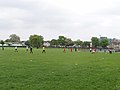 Football on North Acton recreation ground - geograph.org.uk - 170894.jpg 640 × 479; 148 KB
-

-

-

-

-
 Friars Gardens, Acton - geograph.org.uk - 174632.jpg 640 × 480; 98 KB
-
 Friars Gardens, North Acton - geograph.org.uk - 241310.jpg 640 × 480; 89 KB
-
 Friars Way, Acton - geograph.org.uk - 174631.jpg 640 × 480; 92 KB
-
 Friary Road green triangle, Acton - geograph.org.uk - 138806.jpg 640 × 480; 123 KB
-
 Friary Road, Acton, eastern end - geograph.org.uk - 138823.jpg 640 × 480; 95 KB
-
 Going up wooden escalator at Greenford 16-06-06.jpg 1,600 × 1,200; 365 KB
-
 Great Western mainline, West Ealing - geograph.org.uk - 142246.jpg 640 × 480; 307 KB
-
 Greenford Broadway - geograph.org.uk - 175143.jpg 640 × 480; 114 KB
-
 Greenford view1.jpg 480 × 640; 52 KB
-
 Hanger Lane (100563559) (2).jpg 3,620 × 2,440; 2.43 MB
-
 Hanwell Wharncliffe Viaduct 205167 3b413d4c.jpg 640 × 480; 108 KB
-
 Hanwell, Church Road, W7 - geograph.org.uk - 205057.jpg 640 × 480; 102 KB
-
 Hanwell, Greenford Avenue, W7 - geograph.org.uk - 205047.jpg 640 × 480; 133 KB
-
 Hanwell, St Ann's School - geograph.org.uk - 206243.jpg 640 × 480; 110 KB
-
 Hanwell, The Viaduct - geograph.org.uk - 205028.jpg 640 × 480; 99 KB
-
 Harlech Tower AKA Nelson Mandela House - geograph.org.uk - 289998.jpg 480 × 640; 111 KB
-
 Haven Green, W5 (2) - geograph.org.uk - 135835.jpg 640 × 480; 111 KB
-
 High Lane Allotments - geograph.org.uk - 201088.jpg 640 × 480; 99 KB
-
 Himalaya Palace Cinema, Southall - geograph.org.uk - 173961.jpg 640 × 480; 131 KB
-

-
 Horn Lane, near Gipsy Corner - geograph.org.uk - 177857.jpg 640 × 480; 91 KB
-

-
 Hotel, Victoria Road, North Acton - geograph.org.uk - 137372.jpg 640 × 480; 63 KB
-

-
-

-

-

-
 Looking up in Hanwell - geograph.org.uk - 209511.jpg 640 × 480; 72 KB
-
 Mohammedi Park Masjid Complex - geograph.org.uk - 174311.jpg 640 × 480; 116 KB
-
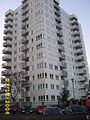
 New flats, Victoria Road, North Acton - geograph.org.uk - 238004.jpg 480 × 640; 109 KB
-

-
 Noel Road, North Acton - geograph.org.uk - 239278.jpg 640 × 480; 89 KB
-
 St Gabriel's Church, North Acton - geograph.org.uk - 137818.jpg 640 × 481; 94 KB
-

-
 North Ealing station, Piccadilly Line - geograph.org.uk - 215167.jpg 640 × 480; 168 KB
-

-

-
 Northcroft Road, Northfields, W13 - geograph.org.uk - 249650.jpg 640 × 480; 278 KB
-
 St Mary the Virgin, Norwood Green - geograph.org.uk - 310121.jpg 640 × 480; 127 KB
-
 Office block, Park Royal - geograph.org.uk - 177878.jpg 640 × 480; 90 KB
-
 Old Hoover Building - geograph.org.uk - 204298.jpg 640 × 480; 75 KB
-
 Park Royal Station - geograph.org.uk - 309330.jpg 480 × 640; 74 KB
-

-
-
 Piccadilly T5 Extension.JPG 639 × 479; 139 KB
-
 Platform, Greenford tube station.jpg 1,280 × 960; 414 KB
-
 Police Station, Greenford - geograph.org.uk - 255192.jpg 640 × 480; 93 KB
-
 Post Office Sorting Office - geograph.org.uk - 142717.jpg 640 × 480; 281 KB
-
-
 River Brent at Hanwell Bridge - geograph.org.uk - 205141.jpg 640 × 480; 116 KB
-
 Seacole Close, North Acton - geograph.org.uk - 177897.jpg 640 × 480; 99 KB
-
 Self Store warehouse, North Acton - geograph.org.uk - 138861.jpg 481 × 640; 72 KB
-
 Shree Jalaram Mandir, Greenford - geograph.org.uk - 173898.jpg 640 × 480; 103 KB
-
 Southall - geograph.org.uk - 210849 (cropped).jpg 352 × 264; 42 KB
-
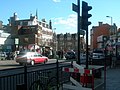
 Southall - geograph.org.uk - 210849.jpg 640 × 480; 90 KB
-

-
 St Mary's Road, Ealing, W5 - geograph.org.uk - 238743.jpg 640 × 480; 285 KB
-

-
 The last stop^ - geograph.org.uk - 286909.jpg 458 × 640; 113 KB
-
 The Plough PH, Norwood Green - geograph.org.uk - 310125.jpg 640 × 480; 122 KB
-
 The Ring Pub and Restaurant - geograph.org.uk - 309323.jpg 640 × 480; 89 KB
-
 TicketMachine.jpg 420 × 550; 63 KB
-
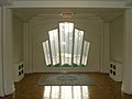 Top floor of the Hoover Building-1393745648.jpg 3,072 × 2,304; 2.65 MB
-
 Top of wooden escalator at Greenford 16-06-06.jpg 1,600 × 1,200; 348 KB
-

-

-

-

-

-
 West Acton (100562723) (3).jpg 2,369 × 3,482; 2.05 MB
-
 West Ealing railway station - geograph.org.uk - 204579.jpg 640 × 480; 72 KB
-
 West Ealing, Manor Road footbridge - geograph.org.uk - 204570.jpg 640 × 480; 122 KB
-
-
 West London Mosque - geograph.org.uk - 174312.jpg 640 × 480; 115 KB
-
 WestActon1.jpg 900 × 600; 298 KB
-
 Westbourne Avenue, Acton - geograph.org.uk - 174628.jpg 640 × 487; 96 KB
-
 Westcott Park Community Centre, Acton - geograph.org.uk - 138856.jpg 640 × 480; 117 KB
-
 Western Avenue (A40), North Acton - geograph.org.uk - 138825.jpg 640 × 480; 84 KB
-
 Western Avenue at Gipsy Corner - geograph.org.uk - 177862.jpg 640 × 480; 80 KB


.jpg)
.jpg)


_(2).jpg)


_-_geograph.org.uk_-_135835.jpg)


.jpg)


_-_geograph.org.uk_-_251607.jpg)


_(3).jpg)


,_North_Acton_-_geograph.org.uk_-_138825.jpg)
