
Category:2000s maps of Florida
States of the United States: Alabama · Alaska · Arizona · Arkansas · California · Colorado · Connecticut · Delaware · Florida · Georgia · Hawaii · Idaho · Iowa · Kansas · Kentucky · Louisiana · Maine · Maryland · Massachusetts · Michigan · Minnesota · Mississippi · Montana · Nebraska · Nevada · New Hampshire · New Jersey · New York · North Carolina · Ohio · Oklahoma · Oregon · Pennsylvania · Rhode Island · South Carolina · Tennessee · Texas · Utah · Vermont · Virginia · Washington · West Virginia · Wisconsin · Wyoming – Washington, D.C.
Subcategories
This category has the following 6 subcategories, out of 6 total.
- 2007 maps of Florida (1 F)
- 2009 maps of Florida (9 F)
Media in category "2000s maps of Florida"
The following 3 files are in this category, out of 3 total.
-
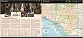 Big Cypress National Preserve, Florida LOC 2005628138.jpg 10,030 × 4,708; 7.4 MB
-
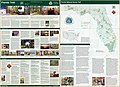 Florida National Scenic Trail LOC 2005628122.jpg 10,012 × 7,241; 10.52 MB
-
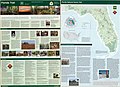 Florida National Scenic Trail LOC 2008624065.jpg 9,990 × 7,208; 10.36 MB


