
Category:1990s maps of Florida
States of the United States: Alabama · Alaska · Arizona · Arkansas · California · Colorado · Connecticut · Delaware · Florida · Georgia · Hawaii · Kansas · Kentucky · Louisiana · Maine · Maryland · Massachusetts · Mississippi · Nebraska · New Hampshire · New Jersey · New York · North Carolina · Ohio · Oklahoma · Oregon · Pennsylvania · Rhode Island · South Carolina · South Dakota · Tennessee · Texas · Utah · Vermont · Virginia · Washington · West Virginia – Washington, D.C.
Subcategories
This category has the following 5 subcategories, out of 5 total.
- 1991 maps of Florida (2 F)
- 1993 maps of Florida (1 F)
- 1994 maps of Florida (4 F)
- 1996 maps of Florida (empty)
- 1997 maps of Florida (empty)
Media in category "1990s maps of Florida"
The following 5 files are in this category, out of 5 total.
-
 Florida Gubernatorial election 1990, results by counties.png 2,000 × 1,771; 196 KB
-
 Gov 1990 fl.png 910 × 808; 14 KB
-
 House82 94.jpg 446 × 336; 9 KB
-
 House92 92.jpg 446 × 336; 12 KB
-
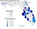 Personnes d'origine canadienne-française (1990).pdf 1,137 × 920; 2.27 MB


