Category:19th-century maps of Victoria, Australia
Jump to navigation
Jump to search
States of Australia: New South Wales · Queensland · South Australia · Tasmania · Victoria · Western Australia
Internal territories of Australia: Northern Territory
External territories of Australia:
Internal territories of Australia: Northern Territory
External territories of Australia:
Media in category "19th-century maps of Victoria, Australia"
The following 33 files are in this category, out of 33 total.
-
-

-

-

-
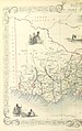
 BOOTH(1873) 1.036 MAP OF VICTORIA.jpg 3,024 × 2,341; 1.38 MB
-
 The Collegiate Atlas 1876 (82452498).jpg 8,343 × 6,677; 6.46 MB
-
 313 of '(Articles on mining and geology reprinted from periodicals.)' (11211389813).jpg 1,431 × 1,562; 670 KB
-

-

-
 424 of '(Articles on mining and geology reprinted from periodicals.)' (11210823814).jpg 1,431 × 1,488; 541 KB
-
 A map of the County of Brenambra (Victoria)1886.png 439 × 381; 230 KB
-
 Admiralty Chart No 1015 South coast of Australia from Guichen Bay to Glenelg River, Published 1872.jpg 16,458 × 12,007; 64.72 MB
-
 Admiralty Chart No 1016 South coast of Australia Corner Inlet to Gabo Island, Published 1872.jpg 21,792 × 11,709; 81.68 MB
-

-
 Admiralty Chart No 1062 South coast of Australia Glenelg River to Cape Otway, Published 1873.jpg 11,700 × 7,941; 30.94 MB
-
 Admiralty Chart No 1171 Australia South Coast Port Phillip, Published 1856.jpg 7,932 × 5,964; 27.57 MB
-
 Admiralty Chart No 1211 Australia Gabo Island to Port Jackson, Published 1888.jpg 8,234 × 12,360; 8.22 MB
-
 Admiralty Chart No 1695b Bass Strait. Western sheet, Published 1868.jpg 8,288 × 12,058; 16.73 MB
-
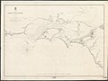
 Admiralty Chart No 1703 Australia, Bass Strait, Corner Inlet, Surveyed 1842.jpg 5,758 × 7,796; 19.87 MB
-
 Admiralty Chart No 1707 Australia, Bass Strait, Port Western, Published 1845.jpg 7,869 × 5,872; 19.93 MB
-
 Admiralty Chart No 1731 Australia South Coast Portland Bay, Published 1845.jpg 7,775 × 5,854; 18.52 MB
-
 Admiralty Chart No 2494 Australia South Coast Lady Bay, Published 1856.jpg 5,052 × 3,906; 9.96 MB
-
 Admiralty Chart No 2504 Australia South Coast Portland Bay, Published 1865.jpg 5,962 × 7,906; 19.1 MB
-
 Admiralty Chart No 2506 Australia, South Coast, Port Fairy, Published 1856.jpg 5,985 × 7,954; 19.85 MB
-
 Admiralty Chart No 2747b Entrance to Port Phillip Eastern Sheet, Published 1870.jpg 10,919 × 15,471; 39.88 MB
-
 Counties of Melbourne (J Sands 1886).png 685 × 583; 349 KB
-
 County of Bourke 1866 zoom elgars special section zoom.jpg 802 × 803; 180 KB
-
 Hawksburn Estate map.jpg 1,600 × 1,134; 708 KB
-
 Karkaroog County vic j sands 1887.png 429 × 692; 378 KB
-
 Map of Millewa county in North West Victoria Australia in 1886.png 377 × 419; 164 KB
-
 Map of Millewa County Victoria Australia in 1886 (J Sands 1886).png 481 × 462; 200 KB
-
 Plan of the Port Phillip District, 1835 by John Helder Wedge.jpg 1,600 × 1,324; 556 KB
-
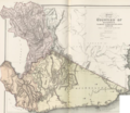
 Squatting districts, New South Wales, Australia, 1844.jpg 1,106 × 1,177; 286 KB
%27_(11038260416).jpg)

_Corner_Inlet_to_Gabo_Island_Surveyed_by_Navg._Lieutt._H.J._Stanley_R.N._1871,_Published_1872.jpg)
%27_(11100226583).jpg)
_1.036_MAP_OF_VICTORIA.jpg)
.jpg)
%27_(11211389813).jpg)

.jpg)
%27_(11210823814).jpg)
1886.png)


.png)


.png)

