Category:19th-century maps of Queensland
Jump to navigation
Jump to search
Subcategories
This category has only the following subcategory.
Media in category "19th-century maps of Queensland"
The following 200 files are in this category, out of 204 total.
(previous page) (next page)-

-
 BOOTH(1873) 2.347 MAP OF QUEENSLAND.jpg 2,321 × 2,975; 3.25 MB
-

-
-
-
 Portland County Queensland, 1890.png 725 × 491; 700 KB
-
 325 of '(Articles on mining and geology reprinted from periodicals.)' (11213798843).jpg 2,448 × 1,026; 423 KB
-

-

-

-

-

-
 Icones ornithopterorum (MAP 2, PL. 3) (7704040378).jpg 1,555 × 2,127; 416 KB
-

-
 611 of 'The International Geography. ... Edited by H. R. Mill' (11169293806).jpg 795 × 1,062; 259 KB
-

-
-

-

-

-
 StateLibQld 2 262776 Estate map of town of Nerang, Queensland, 1890.jpg 751 × 1,000; 68 KB
-

-
 StateLibQld 2 262792 Estate map for Isistown, Isis, Queensland, 1886.jpg 619 × 1,000; 150 KB
-

-

-

-

-

-
-

-
 StateLibQld 2 262864 Map of Eldernell Estate Hamilton, Brisbane, 1890.jpg 622 × 1,000; 98 KB
-

-

-

-

-

-

-

-

-
-

-

-

-

-

-

-

-

-
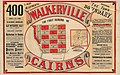
 StateLibQld 2 263096 Estate map of Walkerville, Cairns, Queensland, 1884.jpg 1,000 × 629; 141 KB
-

-
 Admiralty Chart No 1029 Danger Pt. to Cape Moreton, Queensland, Published 1869.jpg 11,125 × 16,281; 65.92 MB
-

-
 Admiralty Chart No 1031 Northern portion of Great Sandy Strait, Queensland, Published 1865.jpg 8,108 × 11,884; 20.36 MB
-
 Admiralty Chart No 1071 Three plans on the East Coast of Australia, Published 1831.jpg 4,087 × 3,042; 2.85 MB
-

-
 Admiralty Chart No 1102 Australia - East coast Queensland, Cleveland Bay, Published 1892.jpg 10,136 × 8,090; 23.09 MB
-
 Admiralty Chart No 1670 Australia East Coast Moreton Bay, Published 1848.jpg 5,853 × 7,873; 8.57 MB
-
 Admiralty Chart No 1670a Moreton Bay, Surveyed 1865-1868.jpg 11,712 × 9,562; 57.86 MB
-
 Admiralty Chart No 1708 Australia Gulf of Carpentaria the Albert River, Published 1845.jpg 7,868 × 5,854; 18.59 MB
-

-

-
 Admiralty Chart No 1900 Australia East Coast Port Curtis, Published 1848.jpg 7,792 × 5,686; 19.57 MB
-

-
 Admiralty Chart No 1937 Adolphus Channel with Albany Pass, Published 1892.jpg 10,887 × 16,196; 23.52 MB
-
 Admiralty Chart No 1937 Australia, Port Albany, Published 1849.jpg 7,904 × 5,831; 20.03 MB
-
 Admiralty Chart No 1948 Australia East Coast Rockingham Bay, Published 1849.jpg 5,872 × 7,850; 21.71 MB
-
 Admiralty Chart No 1952 Australia East Coast Port Bowen, Published 1849.jpg 5,758 × 7,884; 9.17 MB
-

-

-
 Admiralty Chart No 2349 Magnetic Island to Double Point, Queensland, Published 1889.jpg 11,846 × 8,093; 18.97 MB
-
-

-

-

-

-
 Admiralty Chart No 2803 Australia East Coast Port Denison, Published 1861.jpg 5,969 × 7,932; 7.23 MB
-
 Admiralty Chart No 2919 Cape Grenville to Cape York, Published 1894.jpg 10,848 × 17,074; 34.71 MB
-
 Admiralty Chart No 345 Sandy Cape to Keppel Isles, Queensland, Published1863.jpg 14,144 × 10,526; 49.47 MB
-

-
 Admiralty Chart No 347 Percy Isles to Whitsunday I., Published 1882.jpg 12,063 × 8,312; 24.26 MB
-
 Admiralty Chart No 348 Whitsunday Island to Magnetic Island, Queensland, Published 1888.jpg 14,585 × 8,592; 41.37 MB
-
 Admiralty Chart No 383 Thursday Island chart 701068131, Published 1894.jpg 7,000 × 5,242; 6.45 MB
-
 Albert River (Discoveries in Australia).jpg 3,571 × 2,642; 4.01 MB
-
 Allison county qld 1900.png 516 × 414; 433 KB
-

-
 Ayrshire county Queensland 1890.png 882 × 598; 1.09 MB
-
 Balurga county Qld 1900.png 673 × 394; 521 KB
-
 Beconsfeild county qld 1900.png 532 × 393; 455 KB
-
 Belmore county queensland in 1900.png 632 × 426; 579 KB
-
 Brisbane and Environs 1886.jpg 1,435 × 2,318; 988 KB
-
 Brisbane Town 1840.jpg 788 × 596; 152 KB
-
 Brisbane, Queensland 1886.png 681 × 589; 542 KB
-
 Cameron county qld 1900.png 566 × 425; 439 KB
-
 Chelmsford County Qld in 1900.png 824 × 344; 410 KB
-
 Cland county Queensland 1900.png 341 × 418; 217 KB
-
 Coleena county qld 1900.png 637 × 415; 565 KB
-
 Cooper county Queensland 1900.png 629 × 430; 431 KB
-
 Dagmar County Qld in 1900.png 619 × 396; 342 KB
-
 Dalrymple county queensland in 1890.png 971 × 627; 836 KB
-
 Davenport County Queensland 1890.png 1,320 × 624; 1.72 MB
-
 Davenport Township land sale map 1889.jpg 6,000 × 3,942; 3.28 MB
-
 District of Burke Queensland 1886 1.png 506 × 490; 230 KB
-
 Dixon (1842).jpg 9,021 × 11,692; 10.14 MB
-
 Douglas county queensland in 1890.png 1,168 × 648; 1.07 MB
-
 Drummond County Qld 1900.png 517 × 402; 318 KB
-
 Dunbar County Qld in 1900.png 568 × 437; 8 KB
-

-

-
-

-
 Franklin county Queensland in 1900.png 657 × 437; 11 KB
-
 Gladysinlet.png 1,113 × 953; 811 KB
-
 Gregory north land district j sands 1887.png 531 × 418; 399 KB
-
 Gregory South Land District 1887 j sands atlas.png 628 × 425; 354 KB
-
 Grey cheviot &Gordon counties Qld 1887 j sands atlas.png 655 × 430; 456 KB
-
 Grey county queensland b.png 707 × 399; 355 KB
-
 Koolatha County Qld in 1900.png 561 × 376; 14 KB
-
 Kyabra&bulgroo in 1900.png 619 × 441; 537 KB
-
 Lang Couunty Qld in 1900.png 365 × 414; 5 KB
-
 Manura county qld 1900.png 559 × 344; 375 KB
-
 Map of Banks County Qld in 1900.png 726 × 432; 530 KB
-
 Map of Cains area in 1890.png 839 × 629; 1,023 KB
-
 Map of Cammerons corner 1886 (J Sands).png 379 × 490; 199 KB
-
 Map of Kyrunda County Queensland.png 771 × 427; 694 KB
-
 Map of Orrey county qld 1900.png 454 × 345; 332 KB
-
 Map of Queensland at Separation in 1859.tiff 3,701 × 4,000, 2 pages; 42.39 MB
-
 Map of the District of Bourke Queensland 1886.png 636 × 484; 311 KB
-
 Map of the District of Burke (Queensland) in 1886.png 260 × 327; 114 KB
-
 Map of the Gulf of Carpentaria 1886.png 511 × 310; 166 KB
-
 Map of the Land District of Gordon Queensland 1886.png 244 × 440; 116 KB
-
 Map of the Queensland counties, 1890.jpg 5,910 × 7,786; 37.98 MB
-
 Map of Torres Strait in 1886.png 360 × 393; 182 KB
-
 Map of Urinye county.png 398 × 430; 343 KB
-
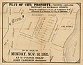
 Map showing proposed site of school.jpg 2,592 × 1,936; 1.29 MB
-
 Maramie County Qld 1`900.png 462 × 384; 377 KB
-
 Maranoa land district 1887 J Sands atlas.png 424 × 616; 505 KB
-
 McKinley County Queensland.png 1,334 × 635; 1.7 MB
-
 Melville county 1900.png 621 × 433; 11 KB
-
 Mexico county Qld 1900.png 294 × 430; 282 KB
-
 Mitchell land district j sands 1887.png 383 × 432; 329 KB
-
 Moorooka Park, estate map, 1889.jpg 3,721 × 6,000; 4.16 MB
-
 Moreton Bay 1846 after Baker with additions.jpg 2,826 × 2,015; 792 KB
-
 Mossman county Qld in 1900.png 393 × 268; 256 KB
-
 NativeWellsCairns.png 832 × 991; 682 KB
-
 Nindscamp.png 1,049 × 707; 788 KB
-
 Norman County Qld in 1900.png 628 × 448; 25 KB
-
 Original map of St Johns Wood Ashgrove 1858.jpg 2,239 × 1,433; 968 KB
-
 Palmer County in Queensland in 1890.png 592 × 765; 837 KB
-
 Pittaroo county queensland.png 616 × 430; 537 KB
-
 Plan of Leases and Claims on the Deep Lead, Gympie, 1869.jpg 8,009 × 6,553; 5.92 MB
-
 Portland County Queensland 1890.png 725 × 491; 630 KB
-
 Proposed site for Mount French School.jpg 2,592 × 1,936; 1.37 MB
-
 Queensland... - btv1b53064934w.jpg 8,392 × 11,000; 14 MB
-
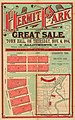 Real estate map of Hermit Park estate, Townsville, 1884 (26305570822).jpg 2,498 × 4,000; 1.56 MB
-
 Real estate map of Kedron Park estate, 1888 (25793072414).jpg 2,639 × 4,000; 1.34 MB
-
 Real estate map of Langlands Estate East, Brisbane, 1886 (25795153513).jpg 625 × 1,000; 448 KB
-
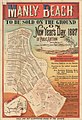 Real estate map of Manly Beach Estate, 1887 (26372005876).jpg 682 × 1,000; 502 KB
-
 Real estate map of Princess Bridge Estate, St Lucia, 1885 (26125061470).jpg 4,000 × 2,547; 1.75 MB
-
 Real estate map of Queensport Aquarium Estate, Hemmant, 1889 (26331712261).jpg 1,000 × 643; 465 KB
-
 Real estate map of Redland Bay township, 1888 (25793072344).jpg 2,545 × 4,000; 1.26 MB
-
 Real estate map of Richter Estate, Annerley, 1889 (26125061420).jpg 630 × 1,000; 471 KB
-

-
 Real estate map of Seville Estate, Coorparoo, 1888 (25793072864).jpg 2,553 × 4,000; 1.14 MB
-
 Real estate map of Southport allotments, Gold Coast, ca. 1885 (26305570092).jpg 2,525 × 4,000; 1.62 MB
-

-
 Real estate map of The Graceville Estate, ca. 1888 (26305569992).jpg 1,000 × 627; 410 KB
-
-
 Robert Dixon's 1842 Survey of Moreton Bay.jpg 8,846 × 11,503; 11.49 MB
-
 Rodney county qld 1900 (1).png 606 × 404; 422 KB
-
 Rodney county qld 1900.png 606 × 404; 559 KB
-
 Rodney County Queensland.png 710 × 611; 857 KB
-
 Rosebery county map,.png 807 × 304; 471 KB
-
 Selwen county qld 1900.png 512 × 406; 396 KB
-
 South Gregory Land District in 1886 (J Sands).png 641 × 352; 234 KB
-

-

-
 StateLibQld 2 107828 Alan Cunningham's map of Moreton Bay district, 1829.jpg 670 × 1,000; 111 KB
-
 StateLibQld 2 108280 Ham's map of the city of Brisbane, Queensland, 1863.jpg 681 × 1,000; 154 KB
-
 StateLibQld 2 119348 Map of Brisbane, 1844.jpg 1,000 × 734; 123 KB
-

-
-
 StateLibQld 2 148763 Survey map of Cairns Harbour, 1878.jpg 1,000 × 761; 87 KB
-
 StateLibQld 2 180739 Squatting map of the Darling Downs district, 1864.jpg 1,000 × 862; 128 KB
-
 StateLibQld 2 202047 Street map of the city of Brisbane, Queensland, 1878.jpg 869 × 1,000; 197 KB
-
 Surry county in Queensland in 1900.png 314 × 421; 289 KB
-
 Torres Straight Islands.png 754 × 641; 693 KB
-
 Walkerroute66.jpg 4,032 × 3,024; 3.73 MB
-
 Wellington County Queensland. Survey Office Brisbane 1900.png 930 × 737; 1.05 MB
-
 Wentworth r county Queensland in 1900.png 809 × 417; 25 KB
-
 Wlison county qld 1900.png 310 × 365; 218 KB
-
 Yagoonya county Qld 1900.png 392 × 396; 265 KB
-
 Yagoonya County Qld in 1900.png 630 × 401; 17 KB
-

-

-
-

-
-

-

-

%27_(11100284913).jpg)
_2.347_MAP_OF_QUEENSLAND.jpg)
.jpg)
.png)

%27_(11213798843).jpg)
_Printed_at_Penang_1863%27_(11152209426).jpg)
_by_William_Saville-Kent_(1845-1908)._Digitally_enhanced_from_our_own_original_edition._(50623708812).jpg)
.jpg)
.jpg)
,_etc%27_(11152077646).jpg)
_(7704040378).jpg)
.jpg)
.jpg)


.jpg)

_(14802071173).jpg)


.jpg)


_of_Map_of_the_Queensland_counties,_1890_Queensland_Surveyor_general_Office.png)
of_Map_of_the_Queensland_counties,_1890_Queensland_Surveyor_general_Office.png)
of_Map_of_the_Queensland_counties,_1890_Queensland_Surveyor_general_Office.png)


.png)


_in_1886.png)


.jpg)
.jpg)
.jpg)
.jpg)
.jpg)
.jpg)
.jpg)
.jpg)
.jpg)
.jpg)
.jpg)
,_South_Brisbane,_1890_(25793072494).jpg)
.jpg)
.jpg)

.png)


.png)


.svg)
.svg)
.svg)