Category:19th-century maps of Pembrokeshire
Jump to navigation
Jump to search

Media in category "19th-century maps of Pembrokeshire"
The following 10 files are in this category, out of 10 total.
-
 Ordnance Survey Drawings - Llanon, Pembrokeshire (Sir Benfro) (OSD 188).jpg 2,557 × 4,000; 3.69 MB
-
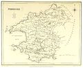 LEWIS(1833) p2.676 PEMBROKE.jpg 2,889 × 2,357; 3.29 MB
-

-

-
-
 85 of '(Our own country. Descriptive, historical, pictorial.)' (11094192083).jpg 890 × 1,138; 303 KB
-
 Admiralty Chart No 1076 St Govens Head to The Mumbles, Published 1888.jpg 19,307 × 10,770; 76.23 MB
-

-

-
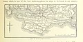
 83 of '(Our own country. Descriptive, historical, pictorial.)' (11156203474).jpg 875 × 1,102; 304 KB
_(OSD_188).jpg)
_p2.676_PEMBROKE.jpg)
.jpg)
%27_(11086062465).jpg)
%27_(11286938956).jpg)
%27_(11094192083).jpg)

%27_(11298302016).jpg)
%27_(11294016753).jpg)
%27_(11156203474).jpg)