Category:19th-century maps of Eastern Europe
Jump to navigation
Jump to search
English: This category is for 19th-century overview maps of Eastern Europe that span more than just one or two specific modern countries. For more detailed maps about specific countries or regions, please check the sub-categories.
Subcategories
This category has the following 11 subcategories, out of 11 total.
- 1800s maps of Eastern Europe (5 F)
- 1820s maps of Eastern Europe (4 F)
- 1830s maps of Eastern Europe (5 F)
- 1840s maps of Eastern Europe (10 F)
- 1850s maps of Eastern Europe (15 F)
- 1860s maps of Eastern Europe (16 F)
- 1870s maps of Eastern Europe (5 F)
- 1880s maps of Eastern Europe (21 F)
- 1890s maps of Eastern Europe (19 F)
1
Media in category "19th-century maps of Eastern Europe"
The following 6 files are in this category, out of 6 total.
-

-
 Administrative division of Russia 1848-1878.jpg 2,697 × 1,717; 1.03 MB
-
 Balkanhalbinsel BV044706388.jpg 12,813 × 9,323; 12.42 MB
-
 Baltikum BV044706384.jpg 13,178 × 9,531; 15.13 MB
-

-
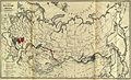 RusImpKazak.jpg 5,936 × 3,606; 17.38 MB


%27_(11007552934).jpg)
