Category:19th-century maps of Bangladesh
Jump to navigation
Jump to search
Media in category "19th-century maps of Bangladesh"
The following 8 files are in this category, out of 8 total.
-
 Northeast-India-in-1814-Thomson-map.jpg 971 × 1,319; 881 KB
-
 Zones de théiculture de l'Assam, 1873.jpg 6,055 × 4,137; 3.46 MB
-

-

-

-
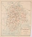 Bakarganj District map.jpg 839 × 960; 248 KB
-
 Districtofbkar00beve 0008.jpg 1,004 × 1,104; 261 KB
-
 Map of former Bakarganj district in 1876.jpg 912 × 1,088; 720 KB


.jpg)
.jpg)
.jpg)


