Category:1973 maps of West Virginia
Jump to navigation
Jump to search
States of the United States: California · Florida · Michigan · New York · Pennsylvania · Texas · West Virginia – Washington, D.C.
| 1973 1974 1975 1976 1977 1978 1979 → |
Media in category "1973 maps of West Virginia"
The following 4 files are in this category, out of 4 total.
-
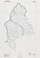
 Greenbrier County, West Virginia LOC 81690015.jpg 10,899 × 9,417; 11.5 MB
-
 Greenbrier County, West Virginia LOC 81690015.tif 10,899 × 9,417; 293.64 MB
-
 Mason County, West Virginia LOC 81690034.jpg 7,904 × 11,443; 7.8 MB
-
 Mason County, West Virginia LOC 81690034.tif 7,904 × 11,443; 258.77 MB

