Category:1960s maps of Iran
Jump to navigation
Jump to search
Media in category "1960s maps of Iran"
The following 8 files are in this category, out of 8 total.
-
 World Aeronautical Chart - Strait of Hormuz.jpg 18,787 × 14,445; 52.32 MB
-
 1967 data of Arabia, Iran and Afghanistan.jpg 3,960 × 2,900; 1.61 MB
-
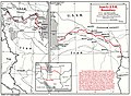
 AFG-IRAN border map.jpg 740 × 993; 146 KB
-
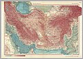 Iran and Afganistan, 1967.jpg 4,064 × 2,884; 2.72 MB
-
 Iran Iraq border map.png 963 × 1,275; 1.29 MB
-
 Iran Turkey border map.png 979 × 1,292; 143 KB
-
 Iran-USSR border.jpg 921 × 678; 177 KB
-
 Shatt al Arab Iran-Iraq border map.png 893 × 1,134; 278 KB


