Category:1950s maps of São Paulo
Jump to navigation
Jump to search
Media in category "1950s maps of São Paulo"
The following 9 files are in this category, out of 9 total.
-

-

-
-
 Estado de São Paulo (Brasil) 1950, Acervo do Museu Paulista da USP.jpg 7,216 × 5,412; 18.88 MB
-
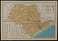
 Mapa da Divisão Administrativa Estado de São Paulo (1959), Fundação Seade.jpg 7,488 × 5,285; 3.09 MB
-
 Mapa da área urbana de Indaiatuba datado de 1951.jpg 7,476 × 4,569; 907 KB
-

-
 Mapa Rodoviário do Estado de São Paulo - 1 (2), Acervo do Museu Paulista da USP.jpg 7,216 × 5,412; 23.48 MB
-
 Planta das Cidades de Santos, S. Vicente e Guarujá - 1, Acervo do Museu Paulista da USP.jpg 6,206 × 4,098; 20.9 MB
.jpg)
.jpg)
,_Arquivo_P%C3%BAblico_do_Estado_de_S%C3%A3o_Paulo.jpg)
_1950,_Acervo_do_Museu_Paulista_da_USP.jpg)
,_Funda%C3%A7%C3%A3o_Seade.jpg)

,_Acervo_do_Museu_Paulista_da_USP.jpg)
,_Acervo_do_Museu_Paulista_da_USP.jpg)
