Category:1946 maps of India
Jump to navigation
Jump to search
English: 1946 maps made in India or from India or showing history of India
Media in category "1946 maps of India"
The following 9 files are in this category, out of 9 total.
-
 1946 Map of Baluchistan by National Geographic.jpg 2,041 × 1,889; 820 KB
-
 1946 map of Kathiawar Peninsula by National Geographic.jpg 908 × 592; 160 KB
-
 1946 National Geogapic map of Bengal and Assam.jpg 1,553 × 1,693; 634 KB
-
 1946 National Geographic map of Northeast India.jpg 1,503 × 2,105; 681 KB
-
 1946 Political Subdivisions of India by National Geographic.jpg 8,584 × 7,478; 3.18 MB
-
 1946 Princely State of Kashmir by National Geographic.jpg 2,487 × 1,628; 1.5 MB
-
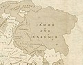 Jammu and Kashmir in 1946 map of India by National Geographic.jpg 1,551 × 1,209; 429 KB
-
 North-East Frontier in 1946 map of India by National Geographic.jpg 1,321 × 835; 250 KB
-
 North-Western India in 1946 map of India by National Geographic.jpg 2,185 × 1,813; 927 KB


