Category:1946 maps of China
Jump to navigation
Jump to search
Media in category "1946 maps of China"
The following 13 files are in this category, out of 13 total.
-
 China Mineral Resources - DPLA - aa30265024fc91c016f8568561360fc6.jpg 8,766 × 7,695; 7.91 MB
-
 Hankow 2nd Edition - NARA - 100306863.jpg 16,832 × 23,363; 19.57 MB
-
 Manchuria "Manchuko" Number of Koreans - DPLA - fd7dad51ca66ec61d78014846c64505a.jpg 4,776 × 5,290; 3.18 MB
-
 Manchuria Coal, Petroleum, Electric Power - DPLA - 489304a2659f858ef0cf715db9d255c8.jpg 4,432 × 4,157; 2.06 MB
-
 Manchuria Construction Materials - DPLA - 9e8fa46d546b5761c45ebe61ddb2e23d.jpg 3,808 × 3,988; 2.1 MB
-
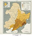
 Manchuria Density of Population - DPLA - 04f3f27e7530ddb9de58da1c033a8a91.jpg 5,366 × 6,012; 4.58 MB
-

-
 Manchuria Roads - DPLA - 6e0ff9d51679b840fa4897f168f2cb7f.jpg 5,400 × 6,033; 3.83 MB
-
 Manchuria Water Supply and Sewage Disposal - DPLA - ef72a16262146f9d8e02bbba091e332f.jpg 3,784 × 4,096; 1.87 MB
-
 Manchuria- An-Shan - DPLA - 83c72bff639d1e256dd43101a7ad8427.jpg 7,000 × 4,138; 2.71 MB
-

-

-


_-_DPLA_-_5ae72f7a1f69955fce1b7fda54cc31ae.jpg)


