Category:1938 maps
Jump to navigation
Jump to search
| ← · 1930 · 1931 · 1932 · 1933 · 1934 · 1935 · 1936 · 1937 · 1938 · 1939 · → |
Deutsch: Karten mit Bezug zum Jahr 1938
English: Maps related to the year 1938
Español: Mapas relativos al año 1938
Français : Cartes concernant l’an 1938
Русский: Карты 1938 года
Subcategories
This category has the following 9 subcategories, out of 9 total.
Media in category "1938 maps"
The following 89 files are in this category, out of 89 total.
-
1938 BERy system map.png 3,500 × 4,700; 34.53 MB
-
Albuquerque Quadrangle Topographical Map, 1938.jpg 2,594 × 3,174; 3.82 MB
-
Balnica 1938.jpg 1,886 × 1,659; 2.38 MB
-
Beijing Shi zui xin xiang xi quan tu. LOC 2006635055.jpg 6,341 × 9,083; 11.12 MB
-
Beijing Shi zui xin xiang xi quan tu. LOC 2006635055.tif 6,341 × 9,083; 164.78 MB
-
Chile, 1938.jpg 2,168 × 1,434; 668 KB
-
Ciechania 1938.jpg 1,697 × 1,154; 1.64 MB
-
Czarne, Beskid Niski, Poland 1938.jpg 1,264 × 952; 963 KB
-
Czeremcha 1938.jpg 1,138 × 789; 786 KB
-
Proprietatile Eforiei Spitalelor Civile in judeţul Brăila (1938).JPG 1,256 × 893; 168 KB
-
Eliyahu Landa, מפת ארץ ישראל המול אלי' לנדא, ירושלים (FL191789633 1100146).jpg 7,590 × 11,318; 98.93 MB
-
French Service géographique de l'armée, Yammoune - Les Cedres (FL79322995 3803352).jpg 15,338 × 17,415; 292.75 MB
-
George Philip & Son, Turkey, Syria and Iraq (Mesopotamia) with Transcaucasia (FL35864554 2367077).jpg 18,987 × 13,020; 365.94 MB
-
Hand-drawn map showing settlements in Belgian Congo Wellcome L0039133.jpg 3,966 × 3,186; 3.79 MB
-
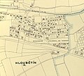
Hloubetin kolonie Za horou.jpg 1,947 × 1,760; 1.12 MB
-
Hloubetin map 1938.jpg 4,959 × 3,594; 5.41 MB
-
Holesovice 1938 cr.jpg 4,303 × 3,712; 5.4 MB
-
Huta Polańska 1938.jpg 1,325 × 1,411; 1.56 MB
-
Jewish National Fund, ארץ ישראל. Eretz Israel (FL32686181 2367884).jpg 12,345 × 17,027; 294 MB
-
Karte Fischhausen-Tenkitten.JPG 346 × 330; 79 KB
-
Koskolovo38 1.jpg 485 × 781; 153 KB
-
Kárpát-medence vízrajza (1938).png 2,747 × 1,775; 12.07 MB
-
Lipna 1936, 1938.jpg 1,761 × 977; 914 KB
-
Lydda airport (FL60908712 2646384).jpg 11,172 × 9,382; 108.29 MB
-
Malešice map 1938.jpg 4,263 × 2,731; 3.61 MB
-
Malešice map 1938cr.jpg 3,120 × 2,210; 2.94 MB
-
Maniów 1938.jpg 701 × 1,044; 559 KB
-
Map of Palestine (New testament period) (FL37828875 3923865).jpg 13,580 × 17,165; 421.92 MB
-
Map of the Royal Commision's partition plan (FL83894280 2760881).jpg 5,683 × 10,866; 58.86 MB
-
Nieznajowa 1938 r..jpg 1,525 × 1,041; 915 KB
-
Oahu 1938 USGS map.jpg 13,691 × 10,253; 21.98 MB
-
Opatovice plán 1938.jpg 1,521 × 1,335; 1.14 MB
-
Ordnance Survey, Proposed boundary between Jaffa and Tel Aviv (FL25570682 2760895).jpg 15,591 × 20,551; 410.18 MB
-
Ordnance Survey, The A plan of partition (FL17237373 2760683).jpg 3,377 × 5,102; 16.82 MB
-
Ordnance Survey, The boundaries of Jaffa (FL37481831 2760775).jpg 6,780 × 8,794; 76.08 MB
-
Peru, 1938.jpg 2,783 × 3,558; 3.45 MB
-
Radocyna 1938.jpg 1,923 × 2,103; 3.28 MB
-
Rand McNally & Co. (Chicago), Division of Alexander's Empire (FL36587318 3917076).jpg 2,765 × 3,438; 3.71 MB
-
Rand McNally & Co. (Chicago), Journey of Abraham in Palestine (FL36587223 3916991).jpg 2,577 × 3,348; 4.57 MB
-
Rand McNally & Co. (Chicago), Paul's Journeys (FL45582187 3917246).jpg 3,381 × 2,748; 4.16 MB
-
Rand McNally & Co. (Chicago), Physical map of Palestine (FL36587262 3916984).jpg 2,634 × 3,347; 4.93 MB
-
Rand McNally & Co. (Chicago), The Assyrian Empire (FL36587284 3917071).jpg 2,752 × 3,438; 2.8 MB
-
Rand McNally & Co. (Chicago), The division of Solomon Empire (FL36587294 3917068).jpg 2,489 × 3,353; 4.44 MB
-
Rand McNally & Co. (Chicago), The empire of David and Solomon (FL36587292 3917061).jpg 2,651 × 3,406; 3.29 MB
-
Rand McNally & Co. (Chicago), The kingdom of Herod the Great (FL36587323 3917086).jpg 2,634 × 3,369; 3.87 MB
-
Rand McNally & Co. (Chicago), The life of Jesus (FL45582181 3917241).jpg 2,664 × 3,393; 4.45 MB
-
Rand McNally & Co. (Chicago), The life of Jesus (FL45582184 3917240).jpg 2,777 × 3,438; 3.4 MB
-
Ropianka 1938.jpg 1,430 × 997; 1.04 MB
-
Rostajne 1938.jpg 1,728 × 1,009; 1.34 MB
-
Rzepedź 1938.jpg 1,656 × 1,234; 1.67 MB
-
SeekarteSchweinesand1938.jpg 2,434 × 1,280; 2.86 MB
-
Smereczne.jpg 970 × 679; 588 KB
-
Solinka 1938.jpg 1,916 × 1,633; 2.3 MB
-
Karta slottet Oberstradam.jpg 9,356 × 9,836; 12.49 MB
-
Survey of Palestine, Beersheba (FL35077202 2695363).jpg 13,534 × 15,018; 286.5 MB
-
Survey of Palestine, Jerusalem 01-north-west (FL25553694 2366984).jpg 14,966 × 17,128; 364.2 MB
-
Survey of Palestine, Jerusalem 02-north-east (FL25553700 2366984).jpg 14,942 × 17,212; 347.49 MB
-
Survey of Palestine, Jerusalem 03-south-west (FL25553704 2366984).jpg 12,826 × 14,457; 221.08 MB
-
Survey of Palestine, Jerusalem 04-south-east (FL25553709 2366984).jpg 15,131 × 17,346; 352.08 MB
-
Survey of Palestine, Kefar Malal registration block 6451 (FL28026040 3519864).jpg 13,510 × 16,348; 269.99 MB
-
Survey of Palestine, Palestine - index to vilages & settlements (FL13735733 2367771).jpg 9,743 × 16,279; 214.82 MB
-
Survey of Palestine, Palestine of the Old Testament (FL50795169 2366860).jpg 8,757 × 14,759; 182.32 MB
-
Survey of Palestine, Ras Ez Zuweira (FL35285964 2695366).jpg 13,734 × 15,326; 290.27 MB
-
Survey of Palestine, Safad (FL10423500 2370068).jpg 7,332 × 10,150; 108.67 MB
-
Survey of Palestine, Survey of Palestine motor map (FL35077098 2639435).jpg 9,690 × 14,820; 212.38 MB
-
The Roman Empire showing the journeys of Paul (FL37828850 3923869).jpg 17,088 × 13,458; 430.35 MB
-
Tour de France 1938.png 599 × 599; 351 KB
-
Turzańsk 1938.jpg 1,733 × 1,680; 2.43 MB
-
Upalten Messtischblatt 1938.jpg 578 × 822; 161 KB
-
USGS Holyoke, MA 30 minute Quadrangle SE (1938).png 3,404 × 4,339; 8.92 MB
-
USGS Holyoke, MA 30 minute Quadrangle SW (1938).png 3,409 × 4,348; 9.11 MB
-
Wilsznia.jpg 1,073 × 975; 905 KB
-
Wola Michowa 1938.jpg 1,693 × 1,208; 1.44 MB
-
Wola Wyżna.jpg 1,977 × 2,116; 3.21 MB
-
Zubeńsko.jpg 1,305 × 1,149; 1.16 MB
-
Żubracze 1938.jpg 1,659 × 1,090; 1.46 MB
-
Залив Кожевникова.jpg 675 × 320; 380 KB
-
Склад Сільний 1938.jpg 921 × 507; 182 KB


