
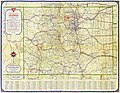
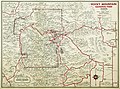
Category:1930s maps of Colorado
States of the United States: Alabama · Alaska · Arizona · Arkansas · California · Colorado · Connecticut · Delaware · Florida · Georgia · Hawaii · Idaho · Illinois · Indiana · Iowa · Louisiana · Maine · Maryland · Massachusetts · Michigan · Minnesota · Mississippi · Missouri · Montana · Nebraska · Nevada · New Hampshire · New Jersey · New Mexico · New York · North Carolina · North Dakota · Ohio · Oklahoma · Oregon · Pennsylvania · Rhode Island · South Carolina · South Dakota · Tennessee · Texas · Utah · Vermont · Virginia · Washington · West Virginia · Wisconsin · Wyoming – Washington, D.C.
Puerto Rico
Puerto Rico
Subcategories
This category has only the following subcategory.
1
Media in category "1930s maps of Colorado"
The following 10 files are in this category, out of 10 total.
-

-

-
 Map of the town of Basalt - DPLA - 69be30b89d139962c104dc852f8bc878.jpg 3,700 × 3,533; 992 KB
-
 Colorado, Denver quadrangle - DPLA - 1097c532bc3f267b62426641ea086a16.jpg 9,000 × 6,062; 7.5 MB
-

-
-

-
-
 Carson and Colorado Railway Route.jpg 1,150 × 2,080; 921 KB
-
 Map of Land Utilization Projects in Colorado (1939).jpg 2,602 × 1,957; 456 KB


.jpg)
.jpg)
.jpg)

.jpg)