
Category:1930s maps of Arizona
States of the United States: Alabama · Alaska · Arizona · Arkansas · California · Colorado · Connecticut · Delaware · Florida · Georgia · Hawaii · Idaho · Illinois · Indiana · Iowa · Louisiana · Maine · Maryland · Massachusetts · Michigan · Minnesota · Mississippi · Missouri · Montana · Nebraska · Nevada · New Hampshire · New Jersey · New Mexico · New York · North Carolina · North Dakota · Ohio · Oklahoma · Oregon · Pennsylvania · Rhode Island · South Carolina · South Dakota · Tennessee · Texas · Utah · Vermont · Virginia · Washington · West Virginia · Wisconsin · Wyoming – Washington, D.C.
Puerto Rico
Puerto Rico
Media in category "1930s maps of Arizona"
The following 6 files are in this category, out of 6 total.
-
-
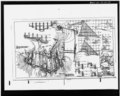
 Arizona & Swansea RR.jpg 1,500 × 754; 380 KB
-
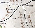 Arizona and Utah Railway Route.jpg 1,489 × 1,217; 509 KB
-
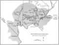
 Map of Land Utilization Projects in Arizona (1939).jpg 1,946 × 2,589; 365 KB
-
 Crown King Branch.jpg 2,222 × 2,736; 2.36 MB
-
 Southern Paiute map 1934.png 1,252 × 956; 1.33 MB


.jpg)

