Category:1928 maps of France
Jump to navigation
Jump to search
Media in category "1928 maps of France"
The following 17 files are in this category, out of 17 total.
-
 Carte géologique de la Savoie et des régions limitrophes - par Léon Moret... - btv1b532132572.jpg 8,989 × 12,433; 26.48 MB
-

-
 Plan Tw Douai 1928.jpg 2,200 × 1,700; 615 KB
-
 Plan Tw Nîmes 1928.jpg 1,700 × 1,590; 1,006 KB
-
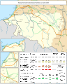
 Plan Tw Poitiers 1928.jpg 2,264 × 2,108; 1.21 MB
-
 Plan Tw Reims 1928 (neufchatel).jpg 649 × 679; 89 KB
-
 Plan Tw Reims 1928.jpg 2,327 × 3,045; 1.37 MB
-
 Plan Tw Rennes 1928.jpg 2,990 × 2,383; 1.31 MB
-
 Plan Tw St-Etienne 1928.jpg 2,942 × 1,736; 1.04 MB
-
 Plan Tw Strasbourg 1928.jpg 3,155 × 2,035; 1.42 MB
-
 Plan Tw Toulon 1928.jpg 2,984 × 2,313; 1.73 MB
-
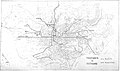
 Railway map of France - 14 - 1928 - fr - small.svg 705 × 879; 7.19 MB
-
 Railway map of France - 22 - 1928 - fr - small.svg 705 × 914; 7.92 MB
-
 Railway map of France - 35 - 1928 - fr - small.svg 564 × 1,056; 8.13 MB
-
 Railway map of France - 55 - 1928 - fr - small.svg 564 × 1,109; 8 MB
-
 Railway map of France - 64 - 1928 - fr - small.svg 776 × 968; 5.78 MB
-
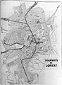 TW Lorient 1928.jpg 2,271 × 3,088; 1.28 MB


.jpg)


