
Category:1920 maps of France
Media in category "1920 maps of France"
The following 27 files are in this category, out of 27 total.
-

-
-
 Carte de l'Europe nouvelle offerte par la maison Ossian Baeckman, Bruxelles - btv1b53064754z.jpg 11,886 × 8,501; 15.09 MB
-
 Carte des mines de potasse d'Alsace. 1 - 30 000 H. Barrère, cartographe - btv1b532098289.jpg 9,116 × 12,858; 17.94 MB
-
 De la Somme à la mer - btv1b53064384p.jpg 6,096 × 9,621; 11.63 MB
-

-

-

-

-

-

-

-

-

-
 Nouveau plan de Clamart. Levé sur le terrain - dessiné et publié par G. Peltier - btv1b53209906z.jpg 8,965 × 10,896; 21.38 MB
-
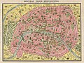
 Nouveau plan de Paris monumental by L. Guilmin, 1920 - Stanford Libraries.jpg 11,319 × 8,367; 16.86 MB
-
 Nouveau plan de Paris monumental by L. Guilmin, 1920 - Stanford Libraries.tif 11,319 × 8,367; 90.35 MB
-
 Plan de Paris à vol d'oiseau by Georges Peltier, ca. 1920 - Princeton University Library - Original.tiff 28,213 × 21,580; 580.67 MB
-
 Plan de Paris à vol d'oiseau by Georges Peltier, ca. 1920 - Princeton University Library.png 28,059 × 21,385; 527.9 MB
-
 Plan de Paris à vol d'oiseau by Georges Peltier, ca. 1920 - Princeton University Library.tiff 28,059 × 21,385; 572.28 MB
-
 Railway map of France - 16 - 1920 - fr - small.svg 564 × 1,003; 4.91 MB
-
 Railway map of France - 62 - 1920 - fr - small.svg 705 × 1,014; 8.22 MB
-
 Railway map of France - 65 - 1920 - fr - small.svg 564 × 1,003; 5.11 MB
-
 Railway map of France - 75 - 1920 - fr - small.svg 564 × 1,020; 4.27 MB
-
 Railway map of France - 78 - 1920 - fr - small.svg 705 × 1,616; 12.94 MB
-
 Rheims and the battles for its possession (1920) (14761053064).jpg 1,808 × 1,948; 349 KB
-

_-_Geographicus_-_Paris-leconte-1820.jpg)


_(14581137040).jpg)
_(14581209918).jpg)
_(14581372249).jpg)
_(14581433637).jpg)
_(14581442357).jpg)
_(14764366681).jpg)
_(14764485891).jpg)
_(14764697251).jpg)
_(14765277274).jpg)


_(14761053064).jpg)
