Category:1919 maps of India
Jump to navigation
Jump to search
English: 1919 maps made in India or from India or showing history of India
Media in category "1919 maps of India"
The following 4 files are in this category, out of 4 total.
-
 1919 Survey of India map of Tibet and Adjacent Countries.jpg 11,628 × 8,112; 11.05 MB
-
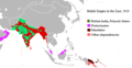 British Empire in the East, 1919.png 580 × 301; 21 KB
-
 British Empire in the East.png 580 × 301; 19 KB
-
 대영제국의 동부지역.png 580 × 301; 15 KB


