Category:1913 maps of India
Jump to navigation
Jump to search
| ← 1910 1911 1912 1913 1914 1915 1916 1917 1918 1919 → |
English: 1913 maps made in India or from India or showing history of India
Media in category "1913 maps of India"
The following 4 files are in this category, out of 4 total.
-
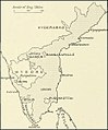 Madras map 1913.jpg 464 × 560; 39 KB
-
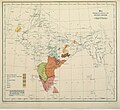 Map showing Distribution of Dravidian languages in 1913.jpg 960 × 878; 336 KB
-
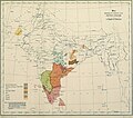 Map Showing distribution of Dravidian languages in 1913.jpg 921 × 815; 304 KB
-
 The empire of India (1913) (14593929100).jpg 3,550 × 2,554; 1.61 MB


_(14593929100).jpg)