Category:1910s maps of Rhode Island
Jump to navigation
Jump to search
States of the United States: Alabama · Alaska · Arizona · Arkansas · California · Colorado · Connecticut · Delaware · Florida · Georgia · Hawaii · Idaho · Illinois · Indiana · Iowa · Kansas · Kentucky · Louisiana · Maine · Maryland · Massachusetts · Michigan · Minnesota · Mississippi · Missouri · Montana · Nebraska · Nevada · New Hampshire · New Jersey · New Mexico · New York · North Carolina · North Dakota · Ohio · Oklahoma · Oregon · Pennsylvania · Rhode Island · South Carolina · South Dakota · Tennessee · Texas · Utah · Vermont · Virginia · Washington · West Virginia · Wisconsin · Wyoming – Washington, D.C.
Puerto Rico
Puerto Rico
Subcategories
This category has the following 3 subcategories, out of 3 total.
- 1911 maps of Rhode Island (2 F)
- 1916 maps of Rhode Island (1 F)
- 1917 maps of Rhode Island (4 F)
Media in category "1910s maps of Rhode Island"
The following 3 files are in this category, out of 3 total.
-
 1913 map of Connecticut River Transmission Company.jpg 739 × 590; 75 KB
-
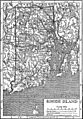 Britannica Rhode Island.jpg 1,146 × 1,648; 829 KB
-
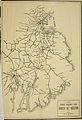 By trolley through eastern New England (1904) (14776558855).jpg 2,656 × 3,872; 855 KB

_(14776558855).jpg)