Category:1910s maps of Indiana
Jump to navigation
Jump to search
States of the United States: Alabama · Alaska · Arizona · Arkansas · California · Colorado · Connecticut · Delaware · Florida · Georgia · Hawaii · Idaho · Illinois · Indiana · Iowa · Kansas · Kentucky · Louisiana · Maine · Maryland · Massachusetts · Michigan · Minnesota · Mississippi · Missouri · Montana · Nebraska · Nevada · New Hampshire · New Jersey · New Mexico · New York · North Carolina · North Dakota · Ohio · Oklahoma · Oregon · Pennsylvania · Rhode Island · South Carolina · South Dakota · Tennessee · Texas · Utah · Vermont · Virginia · Washington · West Virginia · Wisconsin · Wyoming – Washington, D.C.
Puerto Rico
Puerto Rico
Media in category "1910s maps of Indiana"
The following 16 files are in this category, out of 16 total.
-
 Annual report of the Indiana State Board of Agriculture" (1852-1910) (19176904398).jpg 1,688 × 2,628; 684 KB
-
 Annual report of the Indiana State Board of Agriculture" (1852-1910) (19364498555).jpg 1,860 × 2,796; 854 KB
-
 Annual report of the Indiana State Board of Agriculture" (1852-1910) (19368521971).jpg 1,676 × 2,612; 700 KB
-
 Electric railway journal (1910) (14574235388).jpg 2,981 × 2,302; 1.04 MB
-
 Annual report of the Indiana State Board of Agriculture" (1852-1910) (19368518691).jpg 1,674 × 2,606; 749 KB
-
 EB1911 Indiana.jpg 1,828 × 2,656; 2.94 MB
-

-
 The Commercial and financial chronicle (1911) (14801951373).jpg 4,210 × 2,608; 1.76 MB
-

-
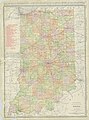 Indiana - NARA - 26335509.jpg 6,176 × 8,342; 8.03 MB
-
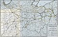 Pennsylvania Lines West of Pittsburgh, Flood of March 1913 (51806780928).jpg 5,548 × 3,499; 14.46 MB
-
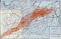 Rainfall, March 23-27, 1913 (51806765503).jpg 6,242 × 3,999; 19.11 MB
-

-
 Map of the State of Indiana - NARA - 25464306.jpg 6,528 × 8,308; 5.07 MB
-
 Map of Indiana - NARA - 25464526.jpg 4,288 × 6,484; 2.29 MB
-
 Map of Indiana - NARA - 25464529.jpg 4,288 × 6,233; 2.35 MB
_(19176904398).jpg)
_(19364498555).jpg)
_(19368521971).jpg)
_(14574235388).jpg)
_(19368518691).jpg)

_(14783208702).jpg)
_(14801951373).jpg)
.jpg)

.jpg)
.jpg)


