Category:1910s maps of Paraná
Jump to navigation
Jump to search
Media in category "1910s maps of Paraná"
The following 7 files are in this category, out of 7 total.
-
 Mappa do Município de Tibagi - 1, Acervo do Museu Paulista da USP.jpg 7,216 × 5,412; 21.92 MB
-

-

-

-
 Mapa do Paraná em 1912.jpg 933 × 660; 257 KB
-
 Maps of German colonies in southern Brazil.jpg 442 × 775; 269 KB
-
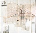 Planta de Curitiba 1913-1914 CR488.jpg 1,723 × 1,611; 378 KB


.jpg)


