Category:1910 maps of Lithuania
Jump to navigation
Jump to search
Countries of Europe: Bulgaria · France‡ · Germany · Lithuania · Norway · Poland · Russia‡ · Spain‡ · Turkey‡ · Ukraine · United Kingdom
‡: partly located in Europe
‡: partly located in Europe
| 1910 1911 1912 1913 1914 1915 1916 1917 1918 1919 → |
Media in category "1910 maps of Lithuania"
The following 8 files are in this category, out of 8 total.
-
 Deutsch-russische Grenzlande.jpg 2,701 × 4,000; 1.56 MB
-
 Evropayskye gubernii Rossii 1910.png 2,042 × 2,003; 1 MB
-
 Grodnenskaya gubernia.jpg 1,311 × 1,520; 1.77 MB
-
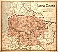
 Kovenskaya gubernia.jpg 1,858 × 1,338; 2.23 MB
-
 LT ukininkas 1910.jpeg 5,118 × 4,580; 3.94 MB
-
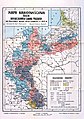 Mapa narodowosciowa 1910.jpg 3,409 × 4,833; 8.66 MB
-
 Poland in 1910 (late Congress Poland).jpg 1,200 × 1,033; 129 KB
-
 Russia in empire. LOC 2004629232.jpg 6,928 × 3,790; 3.48 MB


.jpg)
