Category:1917 maps of Lithuania
Jump to navigation
Jump to search
Media in category "1917 maps of Lithuania"
The following 9 files are in this category, out of 9 total.
-
 17-Karte des russischen Kriegsgebiets zwischen Ostsee und Schwarzem Meer (1917).png 9,673 × 13,660; 212.92 MB
-

-
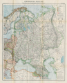 34-Europäisches Russland (1917).png 9,917 × 12,265; 169.31 MB
-
 39-Litauen, Kurland und Livland (1917).png 9,917 × 12,365; 190.12 MB
-
 Biełarusy. Беларусы (J. Karski, 1917).jpg 1,966 × 1,605; 966 KB
-
 Hand-drawn map of the Eastern Front of World War I in Latvia and Lithuania.jpg 5,517 × 8,836; 9.39 MB
-
 OberOst.jpg 315 × 554; 92 KB
-
 OberOstMap-fr.png 1,196 × 2,000; 551 KB
-
 Zapadnye gubernii Rossii 1917.png 2,042 × 2,003; 870 KB
.png)
.png)
.png)
.jpg)


