Category:1904 maps of Ohio
Jump to navigation
Jump to search
States of the United States: Illinois · Louisiana · Maryland · Michigan · Minnesota · Mississippi · Missouri · Montana · Nebraska · Nevada · New York · North Dakota · Ohio · Pennsylvania · South Dakota · Texas · Utah · Washington · Wisconsin – Washington, D.C.
| ← 1900 1902 1904 1905 1906 1907 1908 1909 → |
Subcategories
This category has the following 3 subcategories, out of 3 total.
Media in category "1904 maps of Ohio"
The following 5 files are in this category, out of 5 total.
-
Cleveland map 1904.jpg 1,576 × 1,154; 843 KB
-
Map of the Cleveland, Painesville, & Ashtabula Railway System (51805823487).jpg 2,292 × 927; 696 KB
-
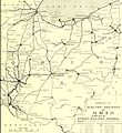
Ohio electric railways, February 1904 (14760158195).jpg 2,528 × 2,748; 822 KB
-
The street railway review (1891) (14758081111).jpg 2,908 × 2,043; 668 KB
-
Toledo, Ohio historical map, 1904 - DPLA - 4212bb95d7dbed1bf7127a3fc1d86055.jpg 9,000 × 6,384; 6.98 MB


