Category:1900 maps of North America
Jump to navigation
Jump to search
Temperate regions: North America · South America · Africa · Europe · Asia · – Polar regions: – Other regions:
English: 1900 maps of North America
Subcategories
This category has the following 2 subcategories, out of 2 total.
C
U
Media in category "1900 maps of North America"
The following 5 files are in this category, out of 5 total.
-
 Arbuckle Bros. Coffee Company (3092909867).jpg 799 × 488; 287 KB
-
 PSM V56 D0082 Glacial map of the great lakes region.png 1,744 × 2,551; 1.37 MB
-
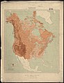 Relief map of Canada and the United States (8346581176).jpg 4,675 × 6,094; 25.5 MB
-
 Review of reviews and world's work (1890) (14597896287).jpg 1,730 × 2,226; 640 KB
-
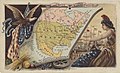
 A.L. Hickmann's geographisch-statistischer universel-Taschen-Atlas. 1900 (80112674).jpg 5,246 × 4,329; 4.17 MB
.jpg)

.jpg)
_(14597896287).jpg)
.jpg)