Category:1899 maps of North America
Jump to navigation
Jump to search
Temperate regions: North America · South America · Africa · Europe · Asia · – Polar regions: – Other regions:
English: 1899 maps of North America
Subcategories
This category has the following 5 subcategories, out of 5 total.
.
- 1899 maps of the Caribbean (10 F)
C
- 1899 maps of Canada (2 F)
- 1899 maps of Cuba (31 F)
M
- 1899 maps of Mexico (9 F)
U
Media in category "1899 maps of North America"
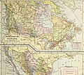
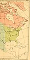
The following 14 files are in this category, out of 14 total.
-
 The geography of mammals (1899) (14579577817).jpg 2,398 × 2,948; 565 KB
-
 1899 Julius Bien View of the Proposed Nicaragua Canal Route.jpg 6,000 × 3,931; 4.98 MB
-

-

-

-

-

-
 Advanced Geography (1899) (14781840875).jpg 2,274 × 2,954; 1.86 MB
-
 Advanced Geography (1899) (14781908635).jpg 3,048 × 2,738; 2.77 MB
-
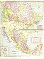 Image taken from page 165 of 'Advanced Geography' (11253710044).jpg 2,597 × 3,456; 2.77 MB
-
 Image taken from page 165 of 'Advanced Geography' (16403077280).jpg 403 × 498; 54 KB
-
 Maudslays' Map of Ixkun 1899.jpg 4,334 × 2,970; 2.54 MB
-

-
 The geography of mammals (1899) (14785908733).jpg 1,532 × 3,004; 462 KB
_(14579577817).jpg)

%27_(11254047776).jpg)
%27_(11251834205).jpg)
.jpg)
.jpg)
.jpg)
_(14781840875).jpg)
_(14781908635).jpg)
.jpg)
.jpg)

.jpg)
_(14785908733).jpg)