Category:18th-century maps of Somalia
Jump to navigation
Jump to search
Countries of Africa: Algeria · Angola · Benin · Cameroon · Cape Verde · Chad · Democratic Republic of the Congo · Republic of the Congo · Djibouti · Egypt‡ · Equatorial Guinea · Eritrea · Ethiopia · The Gambia · Ghana · Guinea · Ivory Coast · Libya · Madagascar · Mauritania · Morocco · Mozambique · Senegal · Seychelles · Sierra Leone · Somalia · South Africa · Sudan · Tanzania · Tunisia
Other areas: Canary Islands · Madeira · Western Sahara
‡: partly located in Africa
Other areas: Canary Islands · Madeira · Western Sahara
‡: partly located in Africa
Media in category "18th-century maps of Somalia"
The following 2 files are in this category, out of 2 total.
-
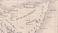
 French map of Somalia in early 18th century.png 643 × 362; 258 KB
-
 Garhajis-Sanaag-Sool.png 1,269 × 714; 1.03 MB

